Try to locate the "Slatyfork Mountain Bike Guide" anywhere but ERTC or Snowshoe. They support taking our trails away through wilderness designation. The map is invaluable and should be available at other locations. I'll check who the printer is and try to post info for locating one. There are a bunch of great trails on this map and some suggested rides that are great. To ride Props Run it's recommended to shuttle unless you like a 6 mile climb on Gravel Rd. and then a few more miles out the ridge. My favorite ride is to park one vehicle at Mine Rd. (FR24) just south of Slatyfork and use another vehicle and begin our ride at Gauley Mtn. Trail on Scenic Rt. 150. Ride Gauley Mtn Trial to Mine Rd., go left on mine road off Gauley Mtn. Trail, then stay right at all the remaining intersections. You will see the sign for props after a large stand of pines on top a hill and then going down a grade with a wide parking area on the right as the road levels. Look back to your right. Note a beautiful overlook of the valley when you pass Sharps Knob. For an extra view, go up the little double track on the left and get a couple more views from ontop the old strip mine area before continuing. Once you reach the Props Run trailhead, ride down Props, which comes out right at ERTC. Please just ride through their parking area and don't spend your money at their business, take a right on Rt.219 and ride about 1.2 miles to Mine Rd. and your vehicle. It's about 19 miles total. If you don't have a shuttle but want to ride this, we usually park at Mine Rd. parking area, ride up Mine Rd. past Gauley Mountain Trial and follow the directions above from that point. It's still about 20 miles that way.


Props Run is one of those trails that if you are in the area you must ride. This trail is not for the faint at heart, but a good intermediate rider will have a great time. The bridge at the end of the ride is impressive.
| ThankPark at Elk River Inn (across little wood bridge), turn right on road, ride up to Mine, turn right, ride up 45min, straight, Right on 24, 15 minutes, R at sign board onto Propp's. As fun a trail as I've ridden in 10 years. Mostly wet, many rocks n little water diversion dips that I learned to flow/center on the bike (stay forward more, midway between seat/stem) better after about 5 of them (just took 10th at nats yesterday, cat 1, so skill level is ok, not recmnd for inexperienced, couple creeks you cross or ride kind of down until catching the continuing trail in your peripheral, but no major obstacles either). Ride Mine Road 45m up, continue until you can go right on 24 (sign), then Right on Propp's (you will see big display to right as you ride 24 for maybe 15 minutes, no more than 30). Good signs. Cliff, nettles sting but stinging stops and you're soaked so that cools the stinging a bit haha, 2 down trees on 7/22/17. Adventure. Just don't get too carried away with speed as there are some corkscrewish spots and toward the end of the techy stuff there's a larger, more jagged rock and I am glad I did not taco a wheel at speed getting through that water dip. Apparently the Inn folks support banning mountain biking in the woods, but they are long time biking supporters, I don't get the dynamics here, but while I was parked there, the lady said it was fine and a local brought several mountain bikes and went in the shop which looked closed, so they must have some grace for the past, it was 10 years ago when this issue was hot, maybe still, IDK Great ride though and Tea Creek or just jump any of the many signed trails.
| ThankI would highly recommend wearing leg and arm protection(long tights and long sleeve jersey) due to the stinging nettles and the overgrown with a bit of brush. We had the ERTC shuttle drop us off at the top and road the 3 miles from the drop point to the trail head. From there it was a mix of roots, rocks, bit of mud and water running across the trail in areas. Was somewhat technical in some areas but was mostly a flowing downhill single track. We really enjoyed the last 1/3 of the trail where it opens up to a wide double track. Overall a great ride, and will do again. Just needs a bit of grooming to cut out the fallen trees and it will be great.
| ThankI rode this with my girlfriend, who is a budding mountain biker. We got the shuttle from ERTC up to within 4ish miles of trailhead. We rode it in late June, and the temp was mid fifties and misty/raining. But we came from SC, so we were not deterred by the conditions. The trail was very wet and overgrown with stinging nettle. At times you could not see upcoming obstacles, but the great majority of the trail is flowing other than some drainage ditches. It was a fun flowing downhill. We emerged very muddy and ready for a beer. It is a trail that can be enjoyed by intermediate and more skilled mountain bikers alike. I would enjoy a bit more technical sections, but nothing is perfect. I can't wait to get back to ride the other sections. I will have to ask the people at ERTC about this wilderness thing, because we talked with them extensively and it never came up, and they were extremely nice to us, and had great beer on draft at the little bar they have.
| ThankThe first 3/4 of the trail was painfully overgrown on our visit. The trailbed was discernible only due to the growth pattern of the vegetation, but the height of the plants bent over the trail and disguised all obstacles and hazards. You usually didn't know you were going through one of the little rock-filled drainage culverts until your front tire dropped into it. The top speed out there for someone who'd never ridden it before was SLOW, and the stinging nettles were extremely annoying. The last part of the trail on private property was a huge relief- faster, cleaner, and with some small climbs. The trail was not very fun overall, and the lack of any interesting descents or climbs left us rather bored between nettle attacks. ERTC was very nice to us- we weren't aware of the local disputes over wilderness bills. * Review edited 7/1/2009
| ThankThis was once my favorite ride in the East before it was rebuilt/rerouted around 1998/99. Much of it now follows a railroad grade and the funnest section of trail has been lost. It's still decent, but not the same.
Even though Gil is kind of a schmuck (and not for supporting wilderness designation - I'm with him on that), ERTC is a good place to have dinner after a hard day riding - check it out.* Review edited 12/1/2008
| ThankRode this trail near the end of August/08 during a mtb weekend. We shuttled up to the top of the mountain using Mine Rd. The trail head is quite a ways down the road and you may think that you've past it already. Keep going. There is a clearing on the right, and the trail entrance is marked with the signs common to the area. The trail is a 8 mile gradual descent. The trail is a wide cut in the mountain, but the used portion is basically singletrack so its fun. There was still some muddy spots, but this was basically the driest conditions you will find in this area. The trail has many washouts from the rainwater making its way down the mountain. These are the fun part and require concentration. Also, I may have been a little complacent and pinch flatted on one of these washouts. Be sure to pump up your tires with lots of pressure. The trail flattens out near the bottom and a few bridge crossings will lead to the end of the trail at ERTC. I suppose if you would like a real challenge, you would go up this trail! This ride was fun, but could use a better link to another trail to make it an awesome ride.* Review edited 9/18/2008
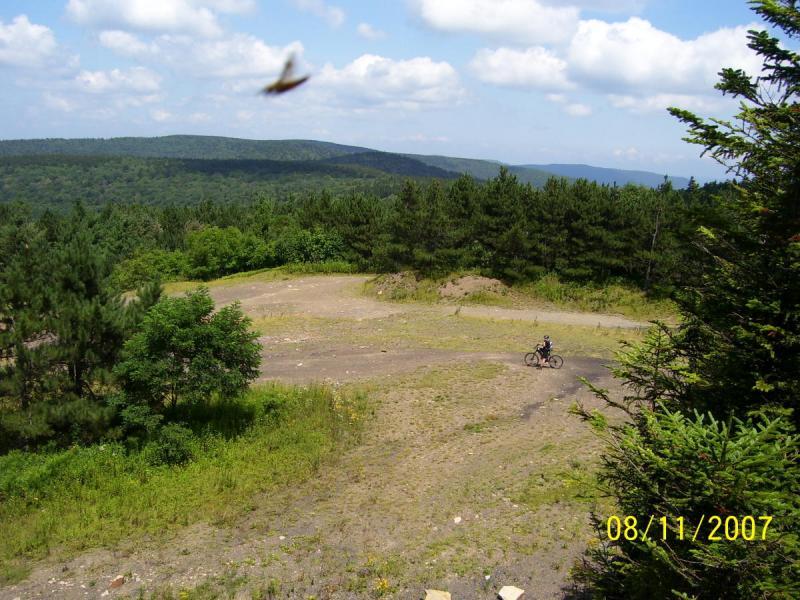
| ThankJust rode Props during the Slatyfork Shuffle June 18th through the 22nd 2008 and the trail is drier than usual. Not to say it is dry, just not quite as much mud as usual. The trail is in great shape. Our group of 8 riders started at Scenic Hwy. 150, rode Gauley Mtn. Trail to Mine Rd., continued out Mine Rd. to Props Trailhead and enjoyed Props to the bottom, and rode right past ERTC.
I found out you can pick up one of the trail maps for the area at Dirt Bean bike shop / cafe'.
I realized Gil and Mary at ERTC used to support mountain biking but it is obvious there is an issue because they have openly supported wilderness designation in our great state. If some call in bashing, well, let it be. They have bit the hand that feeds them. Bash Bash Bash. Please don't spend your money or participate in an even sponsored by them. Support businesses that support mountain biking, buy your map at Dirt Bean or another location.
| ThankProps Run is a good downhill run, but by itself would not be worth the trip. However, in combo with all the other great trails off of Mine Road, it is an epic spot.
It is strange to hear ERTC getting trashed in previous reviews, since they are also the hosts of the Wild 100, a 13-year old epic race. They do a great job of hosting this event, and long may it continue. http://www.ertc.com/wild100.cfm. It was my introduction to "marathon" racing
Props Run will work out your triceps and upper body more than your legs. It is one of those trails that you control, though. Most can ride it slow. Ride it fast and you will feel it. Ride it really fast after 6-hours of riding these wild woods and you will be challenged to just keep hanging on all the way down.
| ThankWell looks like the Slatyfork Mountain Bike Trail Guide is only available through ERTC so I'll spend some detailed time, using my data and make a good map for everyone to use with some ride descriptions of my own.
| ThankImportant error correction for this trail and others in the Slatyfork region. Please do not visit or spend you dollars at ERTC or Snowshoe. They have sponsored a wilderness bill that will make trails in the surrounding counties "Off Limits" to mountain bikes. Please do enjoy the trail, just don't stop by ERTC at the bottom of Props Run. Believe me I feel raped by them.
| Thank