×

|
Rate it:
Tags:
Level:
Length: 14 mi (22.5 km)
Surface: Singletrack
Configuration: Out & Back
Elevation: -
Total: 7 riders
Mountain Biking Old Military Road Trail
#30 of 68 mountain bike trails in Oklahoma
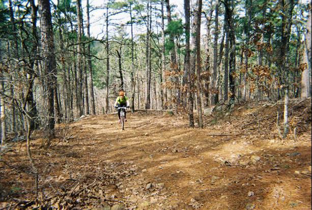
Singletrack that crosses creeks and roads. Out and back, 7 miles one-way. Some doubletrack. There are some sections, like creek beds, that almost all people will hike-a-bike. Rock outcrops and loose rock in some sections. Very taxing trail, bring water and enthusiasm. Don't bike alone, and sign in at the trailhead. Plenty of bugs (yes...ticks too).
First added by dauw on Jan 12, 2005. Last updated May 11, 2020. → add an update
Before you go
- Drinking water: unknown
- Lift service: unknown
- Night riding: unknown
- Pump track: unknown
- Restrooms: unknown
- Fat bike grooming: unknown
- E-bikes allowed: unknown
- Fee required: unknown
This trail information is user-generated. Help improve this information by suggesting a correction.
Take US HWY 271 east from Talahina, OK. Pass the Winding Stair Visitor Center (a few miles), and take a right (south) on Holson Valley Road. You will see a sign for the trailhead after a couple of miles. Take a right (West) into the parking lot.


?
| Thankmore of a hiker trail - there other Enduro style trails in the area that are top notch- beautiful place tho
| Thankthis area is part of the Orock zone and great things are happing every year since 2015
| Thankso get out and get ya some of the great Ouachita trail- now that MTB's are allowed on the all the OKlahoma side about 40 plus mile and there is about 80 miles in the interior.
this is party/gnarRock territory and home the the Orock Enduro
The Old Military Road Trail partially follows the road that was built by the military in 1832 between Fort Smith, AR and Fort Towson, OK. Many features of the original Military Road can still be seen from the trail just north of the picnic area. This old road also provided access to settlers in the area and wagon trains headed west. This is a more difficult trail where it climbs Winding Stair Mountain. Boardstand and the Old Military Road Trail is marked with White Rectangles; Blue Rectangles mark the Ouachita National Recreational Trail. Recommended Seasons: Autumn through Spring.
| ThankI rode this again in July, 2005 and it was still sweet. I was expecting it to be hot, but it wasn't too bad because the trail is mostly shaded. Its still rocky with some very technical climbs and downhills, and an epic climb from Holson Valley Road to Tahlihina Scenic Drive. It's still a bomb back down. The only summer drawback is that about 0.5 miles of the section closest to Talihina Scenic Drive was overgrown, but still rideable.
| ThankExcellent trail! If your doing the entire out and back, start at the Holson Valley Rd. trailhead. Then it'll be mostly up one way, and down on the way back. If you're doing only one way, start at the HWY 1 trailhead (or and extra 0.5 miles at the State Park). You can also ride the HWY up, and ride the trail back down. Bring extra tubes and tires-lots of sharp rocks. I rode in February with cool weather, little undergrowth, and no ticks!!! Trail is well marked. Plan for 3-5 hours.
| Thank