×

|
Rate it:
Tags:
Level: Advanced
Length: 1 mi (1.6 km)
Surface: Singletrack
Configuration: Out & Back
Elevation: -
Total: 4 riders
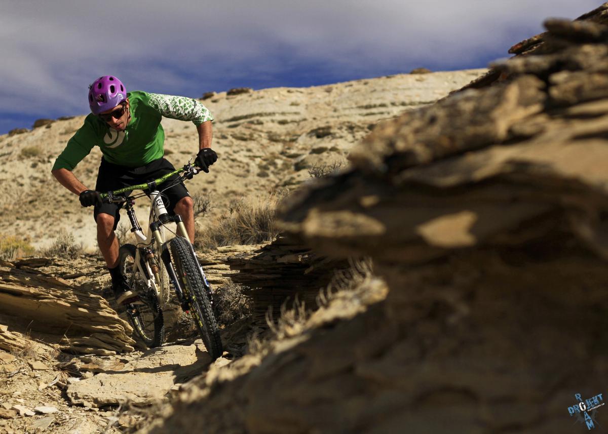
Mountain Biking Draino
#50 of 258 mountain bike trails in Wyoming
This trail can be ridden two ways. Use it as the beginning of your ride at Parking Lot B as described above. Draino is the primary gateway to the Wilkins Peak Trail System. The wash ride varies in surface from shale, sand or rock often depending upon previous rain storms. Staying on Draino after the NoMoJo junction continue straight ahead. The trail climbs steeply for another 1/4 mile until the maximum elevation of Draino has been achieved. Once out of the wash canyon you'll meander east and south across the plateau where the trail crosses Forest Service Road 171, which brings you to the junctions of Brent & Mike's Trail and Pick Your Poison. If you have already ridden the trails that connect Pick Your Poison with Brent & Mike's then you're ready to head back down. Here is the second way. Use Draino for an incredible downhill test of your suspension and be prepared to giggle like a little girl when you get out of the canyon. Draino is a workout climbing up but an amazing rush coming down, turning ledges you climbed up into launching pads and high banked turns flying down.
First added by greyhairbiker on Mar 18, 2013. Last updated Apr 28, 2020. → add an update
Before you go
- Drinking water: unknown
- Lift service: unknown
- Night riding: unknown
- Pump track: unknown
- Restrooms: unknown
- Fat bike grooming: unknown
- E-bikes allowed: unknown
- Fee required: unknown
This trail information is user-generated. Help improve this information by suggesting a correction.
(taken from the Wilkins Peak Trail System map available at the Green River Visitor Center).
To get to the trailhead from Parking Lot B (N41 29.604 W109 25.761)start on the Scott's Bottom Road and turn right through a wash in front of you and follow a two track road south around the hill, towards the river, working your way southeast to the canyon. Drop here through the next ravine folloeing the right fork up the canyon. Your next drop will be in the wash where the trail meets Fast Exit trail coming down. Make a left turn and proceed up the wash as it makes its way up. The trail will take the obvious forks in the wash and the trail stays in the wash until climbing out and passing the upper trail head for NoMoJo Trail on the right. N41 29.577 W109 25.497


This is how I get up the hill to access other trails. It definitely wakes up the legs and gets me warmed up. You can ride it downhill, but I usually opt for Fast Exit when it's time to head down the hill.
| ThankUsed mostly as an uphill trail to access the upper trailheads, but is evolving steadily into a sweet downhill ride!
| ThankAn interesting trail especially when bombing it down.
| Thankawesome short techy trail that can be an easy climb in the wash and more intermediate the faster you descend. Every time I ride it I find little features I have to try on the next ride.
| Thank