There are few experiences more gratifying than climbing a mountain peak. Looking back down on the world below, the ridges, valleys, and cirques represent memories: god and bad. Maybe in a certain gully you and your buddies fought to keep your tent up in a July snowstorm. Or what about that ridge, where the world’s highest spitting contest was held? Things like that make a summit mission about more than just a view or bragging rights. Looking down, you can see a timeline of the struggles, triumphs, and transformations encountered along the way. It’s not about the fact that you got there; it’s about how you got there and the resulting personal growth and life experience gained.
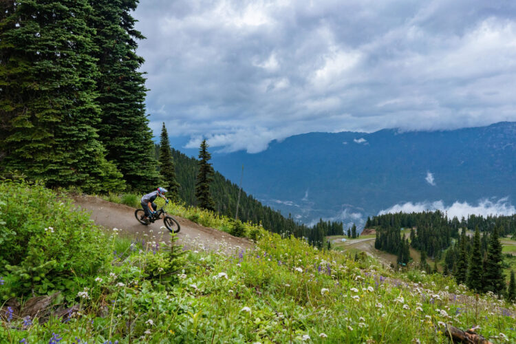
Climbing a peak with a mountain bike is even more satisfying. Not only do you get the pleasure of self-reflection, but you can enjoy a tangible reward: barreling down thousands of feet of scenic alpine terrain. In addition, using a mountain bike makes more remote peaks accessible because even in the harshest, most oxygen-deprived environments, bikers can often travel double the distance of their hiking counterparts.
Despite all the pleasure that can come from conquering a peak, very few bikers get any exposure to such an undertaking. Due to the brutal nature of the first half of these adventures, these are not for the faint of heart. But these 10 mountain bike summits are among some of the most rewarding riders will find in the world!
Mount Elbert
If you want to get your summiting career off to a roaring start, Mount Elbert, a Colorado 14er and the highest point in the Rockies, is a great choice. From the trailhead, a smooth ribbon of dirt slowly winds its way from a semi-arid landscape into large stands of aspen. Roaring creeks, sculpted turns, and a an occasional view will help ease your pain on this portion of the climb.
Eventually, the real climb starts to set in with rock gardens and steeper grades becoming more prominent. The trail, meandering at first, straightens out above the treeline. At this point the trail becomes even steeper as views of North Park and the Upper Arkansas River Valley unfold, with the only consolation being that the rock gardens disperse. However, that doesn’t mean the rocks disappear. They are just more evenly spaced once riders reach the far upper slopes of the mountain.
Finally, after a long, arduous journey, riders make it to the top. Take a couple summit photos, soak in the views of the Collegiate Peaks, and get ready to rip a completely rideable (and incredibly entertaining) plummet from the summit!
The Details
- Elevation: 14,439′
- Net elevation gain to summit: 5,179′
- Distance: 9.9 miles
- Nearest town: Leadville, Colorado
- Nearest campground: Twin Peaks Campground
- Best post-ride restaurant: High Mountain Pies
Mount Taylor

Mount Taylor, an extinct stratovolcano west of Albuquerque, New Mexico, is a great option for an easy summit. Starting only 700 feet below the top, the trail quickly climbs out of the pass between Mount Taylor and the La Mosca Lookout. The beginning of the climb is very exposed and contains a few jagged rock gardens, so be sure to take it easy in the beginning.
Soon the climb transitions into a forest trail with a steep start followed by a few lazy switchbacks. Although the climb itself is easy, flatlanders like myself will struggle a little bit with the elevation. When riders arrive at the summit, they will be greeted by one of the greatest views the author has ever seen. Everything from the mesas of the mountain’s lower extensions to the blackness of the lava flows of El Malpais will be on display as the diverse landscape unfolds below.
Then the fun begins. Riders, navigating rock ledges and the remarkably loose pumice and basalt of the mountain, will fly down the volcano, their knobbies eating (or trying to eat) every bit of trail thrown at them. After a few long switchbacks, the trail’s bends disappear for a segment literally straight down the mountain.

Further down, aspen and pine trees loom above mere mortals as the soil changes from loose tread to tacky hero dirt and then again to dusty, pale brown hardpack. There, any roots and rocks will vanish and riders will be free to pump their way through the terrain’s natural flow.
After meeting an old logging road and taking a right to meet the trail again, a forest service road will appear. Take another right and watch for a CDT marker. Once riders are on the CDT, the trail will meet up with a canyon rim and gently descend 1,800 feet in 8 miles via swooping, bright red turns. The mesa top eventually reaching an end, the grand finale to this 5,000 foot descent will commence: a tight, rhythmic 1,500 foot drop with the occasionally unpredictable rock garden to test riders’ technical chops.
The Details
- Elevation: 11,301′
- Net elevation gain to summit: 683′
- Distance: 18 miles
- Nearest town: Grants, New Mexico
- Nearest campground: Lobo Canyon Picnic Ground
- Best post-ride restaurant: El Cafecito
Little Bald Knob

Not all of the best bike summits have to be 10,000+ feet; in fact, sometimes smaller summits present even more of a challenge than their taller counterparts. A perfect example is Little Bald Knob, a 4,300 foot mountain west of Harrisonburg, Virginia along the Virginia/West Virginia border. The obvious choice in the area was initially Reddish Knob, which features a 3,000 foot descent down into the Shenandoah Valley. The only detail that keeps Reddish Knob off this list is that the summit experience lacks a wilderness feel. A road to the top lined with steel guardrails and graffiti makes it seem as if the top of Reddish Knob is a stop right off of I-80. Where’s the fun if you can just drive?
That is where Little Bald Knob gains the upper hand. In addition to the peak only being accessible via trail, it doesn’t have to be completed as an out and back for a complete singletrack experience. A nearby road does make it accessible from Reddish Knob, and the descent off the mountain on the Wild Oak Trail is just as epic as Reddish.
At Horse Trough Hollow, riders are immediately confronted with an 1,800 foot climb to the peak. If you are not already aware, mountain biking the ridges of Virginia involves a lot of rocks, and the Wild Oak Trail won’t disappoint. Couple this with the painfully elevated grades of the climb and a liberal dose of Appalachian roots, and riders will be in for a suffer-fest to the top. Once they get there, they are left in a field surrounded by trees. Don’t worry, as a view is nearby. Find the rock outcropping that extends out from the summit ridge for great views of Shenandoah Mountain, Shenandoah Valley, and the Blue Ridge itself.
Pointing their steeds downhill, riders will get rowdy on one of the biggest descents on the East Coast. They’ll boost beautiful wooded drops and jumps while railing the occasional berm in between. To add some contrast, the more natural side of the mountain biking coin will serve up abundant root webs, rock obstacles, and janky rock jumps. Continue on the trail past Grooms Ridge until the Skidmore Fork/Grindstone Ridge intersection appears. Then, savor every moment of the steep, primal final descent to the Wild Oak Trailhead.
The Details
- Elevation: 4,351′
- Net elevation gain to summit: 1,896′
- Distance: 10.0 miles
- Nearest town: Stokesville, Virginia
- Nearest campground: North River Campground
- Best post-ride restaurant: Corgans’ Publick House, Harrisonburg, Virginia
Snowdon
Although Americans tend to think of the Scottish Highlands when pondering British peaks, our friends across the pond have many more mountain ranges than we think. A paramount example is the towering pinnacles of Wales’ Snowdonia. Luckily, mountain bikers are actually allowed to bike the region’s highest peak, Snowdon, on one of the most unforgiving loops in Europe.
After riding through the town of Llanberis to the beginning of the Llanberis Path, the trail starts to wander its way through open meadows over very loose terrain filled will tire-eating boulders. Don’t be afraid to take breaks from the taxing climb because a wonderful view of the town below and the surrounding countryside will be on tap for the entirety of the adventure. Continuing up, the trail steadily becomes steeper and hiking-a-bike plays an increasingly heavy role in the trip. However, the rolling pasture becomes more dramatic, with craggy buds of rock reaching out of the grass.
The precarious summit mounted, riders will want to take a break to refuel; after all, the descent is nearly as taxing as the climb. On the start of the plunge down the Llanberis Path, a few relatively technical sections and a staircase will give riders a mere taste of what is to come.
Take a left at the pillar denoting the Ranger Path. The Ranger Path is one gnarly beast; riders will easily get unnerving speed while going through incredibly rough, unpredictable terrain. Nonetheless, that is just the beginning. Finding their way into the middle section, riders realize the stakes are raised even higher as rocks turn into boulders and grades pitch steeper. The trail, essentially a chute at that point, then wrings riders through its unrideable climax before subduing into a flatter track.
Once riders run into the first gate of the descent, they’ll notice a small valley in front of them. Unfortunately, they’ll have to cross the stream at the bottom and bust a lung climbing the other bank. The pain is well worth it though because on the other side lies a lively water-bar-staggered descent toward a faint trail going back to Llanberis. Riders should follow it to the right up another pasture-adorned climb and stay on the left side of the valley, where a descent filled with awkwardly-spaced water bars waits to be tamed. It might not be conducive to speed, but bikers can still make the most out of the descent by showing off their boosting skills.
Eventually, the trail becomes a road. Just take it down into Llanberis, where some high fives with the crew will be in order.
The Details
- Elevation: 3,560′
- Net elevation gain to summit: 3,160′
- Distance: 11.5 miles
- Nearest town: Llanberis, Wales
- Nearest campground: Camping In Llanberis Campsite and Glamping Yurts
- Best post-ride restaurant: Llygad yr Haul
Joss Mountain
The remote Monashee Mountains of British Columbia beckon to be explored. Massive glaciers, rushing rivers, and mountains with enough sheer vertical to make a mountain biker cry tears of joy surround small mountain towns like Revelstoke. Although Mount Cartier, the most famous peak to mountain bike in the area, is the obvious choice for this list, most riders take a helicopter to a high ridge, and then hike to the summit. For this reason, another famous peak in the area, Joss Mountain, is a better choice for this list of peaks that can be summited by bike.
Joss is truly one of the best alpine trails in British Columbia, and it conveys this right from the start. After navigating a maze of ratty dirt roads to the start of the trail, a climb begins through untouched forest and avalanche shoots. The trail is excessively rocky and rooty on this portion, so expect to be pondering how awesome descending that terrain will be as you hike-a-bike your way up. As a note, remember bear spray for this ride; indeed, the lower slopes of the mountain are known to have a substantial population of our not-so-little furry friends.
After conquering a nasty set of switchbacks, riders emerge above treeline into an alpine wonderland. Sheer cliffs wall in crystal clear alpine lakes. Postcard views of deep gorges, wild flowers, and sprawling glaciers surface at every turn. Riders waltz (and occasionally ride) through a landscape teeming with life yet devoid of it at the same time. The best part? Unlike many mountains, the riding gets easier the higher you go on Joss. Consequently, most of the upper portion can be ridden with a good pair of legs and lungs.
At the summit, riders soak in the views and check out a permanent stone hut. Just in case, remember that it makes a good place to go if bad weather strikes. Then, the only thing left to do is ride 4,000 feet down one of the best descents in Canada!
The Details
- Elevation: 7,793′
- Net elevation gain to summit: 3,429′
- Distance: 11.8 miles
- Nearest town: Revelstoke, British Columbia
- Nearest campground: Frog Falls Recreation Site
- Best post-ride restaurant: The Village Idiot
White Mountain Peak
California is known for its variety of scenery, and White Mountain Peak is no exception. Rising almost 10,000 feet above the surrounding valleys, this 14,242 foot monster serves as the highest peak in the Basin and Range Providence of the West. Oddly enough, a hut-sized laboratory is located at the summit for high-altitude experimentation, meaning that a “road” goes to the top.
From the Barcroft Gate of White Mountain Road, riders start their way up this 2,000 foot climb on slightly rocky but completely rideable doubletrack. Make sure to take in the enormous views of the barren, moon-like peak above and the desolate Owen Valley 8,000 feet below. Watch out for marmots, too; a motorist warning sign is posted at the beginning of the ride as rumor has it the cute, furry alpine creatures have crawled into engine compartments before. At this altitude, the relatively smooth road won’t be the problem. It will be the fact that the ride starts at more than 12,000 feet above sea level.
Once riders make their way into the “upper alpine,” the zone where grass doesn’t even grow, the road becomes significantly more technical. Instead of being a dirt track with a couple rocks, it becomes a pile of loose scree. Because of its steep, loose, and rough nature, even the toughest climbers will be pushing their bikes by that point.
Soak in the views, snap some photos, and eat something at the top. Once riders start down, they’ll need all the energy they can get, for going down the scree road isn’t much better than going up. It is so loose that the best pace many riders can achieve is a slow, shifty rock-crawl. But that will eventually give way to dirt on the lower portion, and it will be smooth sailing from there.
The Details
- Elevation: 14,242′
- Net elevation gain to summit: 2,145′
- Distance: 14 miles
- Nearest town: Bishop, California
- Nearest campground: Grandview Campground
- Best post-ride restaurant: Great Basin Bakery
Ras Deshan
Africa is big. Its animals are big, its rain forests are big, and its deserts are huge. Luckily, peak-bagging mountain bikers will find multiple rideable peaks that are big too. A good introduction to the epic African summit expeditions, Ras Dejen rises above the rest of Ethiopia and the Simien Mountains to a height of 14,928 feet. Despite being the smallest of the big African peaks, its height isn’t what makes it challenging; it’s the days of riding and painfully large amount of climbing that’s needed to get there.
According to the route a couple of Giro athletes and photographer Dan Milner took in 2014, the ride starts at the Aynameda Camp high in the Simien Mountains. Because only a couple mountain bikers have ever rolled knobbies in the National Park, expect a crowd of anxious and awestruck children at almost every village. While riders traverse their first windswept slope of the trip, an escarpment nearly 7,000 feet tall will be looming on the left side. Make sure to stop to fully appreciate the fantastically foreign land. On the dry, barren edges of the massive cliff, scrubby trees dot the area, rooted in rocky, pale brown soil among wispy blonde grass. Loud baboons with a rambunctious attitude will be sharing the view with riders. It’s hard not to get consumed by a grand sense of adventure amidst a scene like that.
From the Chenek Camp, riders begin the long slog up the ridge to Bwahit, Ethopia’s third highest point at 14,557 feet. On this day, they’ll have to navigate more rocks on this mean handlebar-pushing segment. Whether you actually summit Bwahit or not, the reward is just the same: a massive descent off the slopes of the 14er into the valley below, complete with big rock gardens and loose switchbacks.
Next, it’s time to summit Ras Dejen after spending the night in Ambiko. A mix a doubletrack and singletrack will guide you through a wild variety of terrain. The valley riding will be loose and dusty; however, higher up the dust turns into hero dirt, the giant lobelia trees lending the climb an other-worldly feel. After ferrying bikes up the last summit push, riders will plummet back down into Ambiko, testing just how good the hero dirt is on the way down.
The last couple days of the expedition challenge riders to get back to civilization. They must push their bikes out of the valley Ambiko rests in, and then push their way down the sketchy goat path that descends into the lowlands.
Although riders will hike-a-bike quite a bit, the rideable portions and the lifelong memories will certainly be worth it.
The Details
- Elevation: 14,928′
- Net elevation gain to summit from Ambiko Camp: 3,093′
- Nearest town: Debar, Ethopia
- Nearest campground: Ambiko Camp (see link for more info)
- Best post-ride restaurant: Bethlehem in Shire, Ethopia
Cerro Guagua Pichincha
Cerro Guagua Pichincha, one of the peaks of an active volcano outside of the Ecuadorean capital city of Quito, is probably the easiest 15,000-foot+ peak you can summit with a bike. To start, riders can drive a car to a parking lot at about 13,600 feet. During the dry season, climbers can get even higher.
The road up the mountain from the parking lot is very smooth, so climbing the 2,100 feet to the summit is hard on the legs but not on the rest of the body. At the red Ecuadorean Civil Defense hut, continue on the road to the left up to the summit. Even though riders can’t technically ride onto the summit, they can park their bikes and walk the last few vertical feet up the ledgy, exposed summit “pyramid.”
Now that the climbing is done, it’s time to check those brakes and start heading down. First, riders scream through the moonscape of the high slopes of the peak down to the Defense Hut. The speeds on the road coming down get can get so high that riders’ handlebars start to wobble. That said, crashing could be disastrous. After finishing, turn left at the Defense Hut to start the singletrack descent all the way into the city.
Over 14 miles on Valle de la Muerte, riders will enjoy 6,800 feet of descending and 2,500 feet of climbing, offering a sampling of Ecuador’s mountain ecosystems. Quickly leaving the high, barren slopes behind, they’ll dive into a lush valley known as the “Valley of Death” where primitive jumps and drops wait to be taken on. Next comes a peaceful ride through rolling farmland where views of the alpine metropolis below provide a deep contrast to the natural feeling of the rest of the trail. Lastly, riders will be dumped out onto a road after undulating through a forest. From there they can either drive away if they set up a shuttle or continue to descend through the city on the area’s downhill tracks.
The Details
- Elevation:15,728′
- Net elevation gain to summit: 2,113′
- Distance: 17 miles
- Nearest town: Quito, Ecuador
- Nearest campground: For this journey, a cheap, or even a fancy hotel in Quito is probably not a bad idea.
- Best post-ride restaurant: Las Corvinas de “Don Jimmy”
Punta Suelza
One of the best peaks to ride in Europe actually isn’t in the Alps. Instead, it is a mountain named Punta Suelza in the smaller yet just-as-epic Spanish Pyrenees. Located adjacent to the French border, the arduous route’s short distance makes it perfect for a mountain biking climber training for one of the bigger African peaks.
From the alpine lake Ibon de Urdiceto, a short doubletrack leads straight into the belly of the beast: incredibly steep singletrack hike-a-bike littered with loose babyheads, extended slickrock sections, and little dirt. This climb will truly test a rider’s mettle; in fact, depending on which route is taken, long periods of bike-ferrying may be in line.
But every scraped knee and laborious step is worth it due to the fact that riders are gifted views of the charming alpine lake below and the nearby fertile plain extending into the distance.
On the descent, riders, picking their way through a slope of decomposed rock and grass, start by flying down a nearby ridge. This portion of the ride will test bike-handling skills, but most advanced riders can clear the majority of it. Even if the trail disappears, don’t worry. As long as riders stay on the ridge, they will make it to the road at the bottom.
While riders can choose to end the route there, another 5,000 feet of descending in addition to the 3,000 they just did awaits on the nearby Collado de la Cruz de Guardia-Bielsa trail. The treeline quickly approaching, riders dive into a pristine forest. The trail transforms into a beautiful ribbon of dirt that punches across streams and features winding turns as it continues its sudden descent into the valley. Before long, Bielsa emerges on the valley floor, and the ride is complete.
The Details
- Elevation: 9,757′
- Net elevation gain to summit: 1,919′
- Distance: 9.5 miles
- Nearest town: Bielsa, Spain
- Nearest campground: Pineta Camping
- Best post-ride restaurant: El Chinchecle
Mount Kilimanjaro
Mount Kilimanjaro: Highest freestanding mountain in the world, one of the highest volcanoes in the world, and the highest mountain in Africa. This is the pinnacle of riding a summit on a mountain bike.
Taking the mountain’s “easiest” route, Marangu, riders are immediately confronted by the best scenery Africa has to offer. Dripping moss clinging to the trees of the rain forest, the jungle start is filled with a jaw-dropping biodiversity. After about 2,800 vertical feet, the huts that will house riders on their first night will appear.
On day 2, forests open up into moorland where giant lobelia and groundsel tower 10 feet above the ground. If it is possible, detouring to the top of the Maundi Crater will provide ominous views of the summit in all of its snow-white glory. Saving energy might be a good idea though; 3,200 feet of climbing at altitude will be sure to leave riders breathless. At the end of the day, riders arrive at the climbing village Horombo Hut, a bustling town of climbers, guides, and porters, to spend a day to acclimate.
Reaching into the desolate high alpine desert on day four, riders will slowly proceed to the Kibo Hut. Make sure to get some sleep, as tomorrow will be the big day! Ascending the rocky path up to the top in the middle of the night, Hans Meyer Cave will offer an opportunity to rest and look back at how far riders have come. Then the climb with continue.
The sun rising at riders’ backs, they will navigate past Gillman’s Point, over the summit crater, and on to the summit. Celebrate the occasion with some photos, a drink, and something to eat. Have fun on the the 13,610 foot descent!
The Details
- Elevation: 19,341′
- Net elevation gain to summit: 13,610′
- Distance: 40 miles
- Nearest Town: Marangu, Tanzania
- Nearest place to stay: Marangu Hotel
- Best post-ride restaurant: Aroma Coffee House in Moshi, Tanzania
Your turn: what is the best peak you’ve summited by bike?