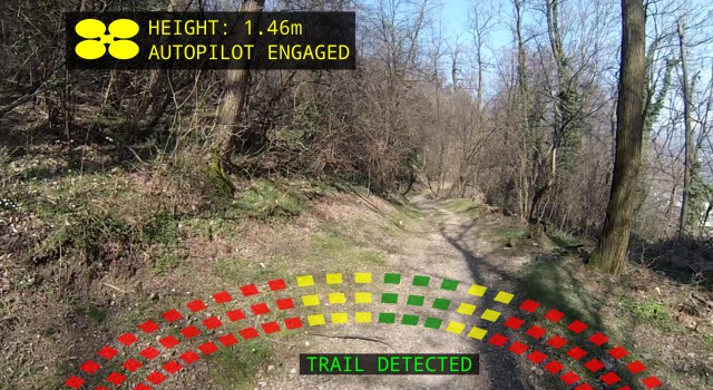
We’ve seen drones with GoPro cameras that can be programmed as “follow cam” flyers, and now this drone software from the University of Zurich can be used to identify trails using artificial intelligence. The University of Zurich project is based around search and rescue scenarios; according to the designers the drone’s speed and accuracy makes it “more effective than human trackers.” I’m not sure I buy that just yet, but as a mountain biker and trail mapper I can see some other interesting use cases for this technology.
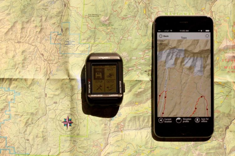
Trail mapping
Of course this would take all the fun out of mapping unknown mountain bike trails but in theory, you could unleash a drone on a trail just to see where it goes. Battery life is a serious constraint with today’s drones, so mapping epic backcountry routes might not be possible. Still, this could be really interesting, especially in places where trail networks are still informal and largely unknown to mountain bikers.
Trail maintenance
If a done can be programmed to recognize a path, then it should be able to recognize when that path is blocked or damaged. Imagine scheduling a regular drone recon mission over a trail to see if there are any trouble spots that need to be addressed. The drone could not only note the location of the blockage but it could also send back images so trail workers know what tools to bring (for example, a chainsaw, or just some clippers.)
Trail guiding
Yes, I guess this would mean the robots are coming for everyone’s job, even the professional mountain bike guides. But if a drone can follow a trail (even an unfamiliar one), mountain bikers could follow the drone to make sure they stay on track. Admittedly this is a pretty narrow use case; most drone trail guides would be better suited to following a pre-set (and known) route loaded ahead of time.
Some trails that are overgrown or rarely used can become hard to see and follow, so if a drone is more accurate than human eyes at picking up subtle clues like soil indentation, this could be helpful. In this situation, a drone might also allow riders to go faster since they don’t have to constantly scan to see where the trail leads.
Trail ratings
Mountain bikers (and mountain bike websites like Singletracks.com) have attempted to rate the technical difficulty of trails for years with varying degrees of success. The thing is, most riders’ own technical ratings of trails are subjective, even when viewed through a framework like the one IMBA has developed. But a drone could quantify every square inch of a trail: how wide it is, how tall obstacles are, where bridges are located, etc. This data could then be crunched to give an objective and exact difficulty rating.
Trail photography/video
Every now and then we hear from a company that’s working on Google Street View-style mountain bike trail coverage (heck, even Google Street View is going places like the Bright Angel trail in the Grand Canyon.) An autonomous trail-following drone would be the perfect tool for building a set of trail photos and videos for a virtual trail experience. My personal opinion? I’d much rather see the trail in person than experience it in virtual reality. Still, some might be interested in experiencing trails in this way.
Your turn: How would you like to see this trail-following drone used for mountain biking?