×

|
Rate it:
Tags:
Level:
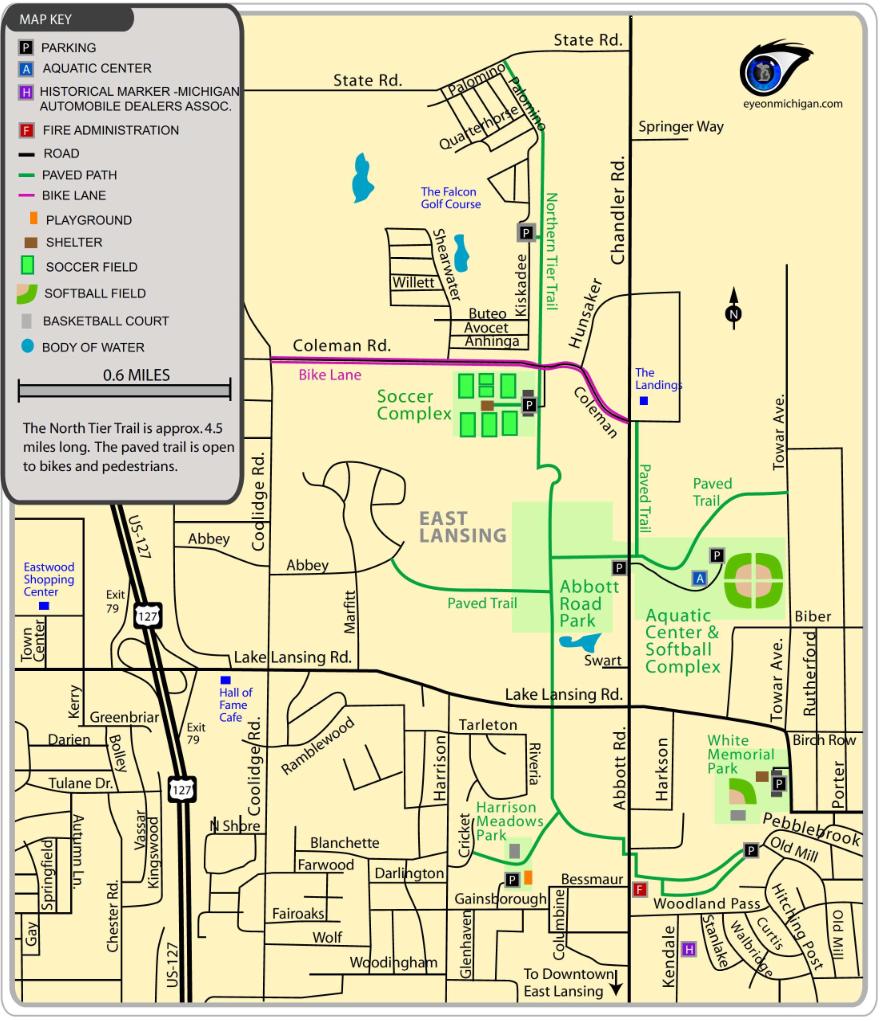
Length: 5 mi (8 km)
Surface: Greenway
Configuration: Out & Back
Elevation: -
Total: 0 riders
Mountain Biking Northern Tier Trail
#307 of 319 mountain bike trails in Michigan
Paved trail connecting several parks
First added by cadams9 on Oct 23, 2016. Last updated Apr 21, 2020. → add an update
Before you go
- Drinking water: unknown
- Lift service: unknown
- Night riding: unknown
- Pump track: unknown
- Restrooms: unknown
- Fat bike grooming: yes
- E-bikes allowed: unknown
- Fee required: unknown
This trail information is user-generated. Help improve this information by suggesting a correction.
1731-1769 Abbot Road
East Lansing, MI 48823
42.753175, -84.483732
https://www.google.com/maps/dir/Whitehills Park/Henry Fine Park/42.7649614,-84.4972396/Abbot Road Park/East Lansing Family Aquatic Center/Northern Tail Dog Park/42.785098,-84.491197/@42.75292,-84.4841806,19.16z/data=!4m34!4m33!1m5!1m1!1s0x0:0x172db8921a0d8883!2m2!1d-84.478293!2d42.7559001!1m5!1m1!1s0x8822e9be8029bb0d:0xdf9d415171c14285!2m2!1d-84.4992767!2d42.7544748!1m0!1m5!1m1!1s0x8822e9a9426692b5:0x41db9eb2bab32e28!2m2!1d-84.4868185!2d42.7666563!1m5!1m1!1s0x0:0xd12c9efe5c9f8038!2m2!1d-84.4811615!2d42.7666416!1m5!1m1!1s0x0:0x52d8397f0941fb6a!2m2!1d-84.4787849!2d42.7685513!1m0!3e1


Loading reviews...View more