×

|
Rate it:
Tags:
Level:
Length: 8 mi (12.9 km)
Surface: Singletrack
Configuration: Out & Back
Elevation: -
Total: 0 riders
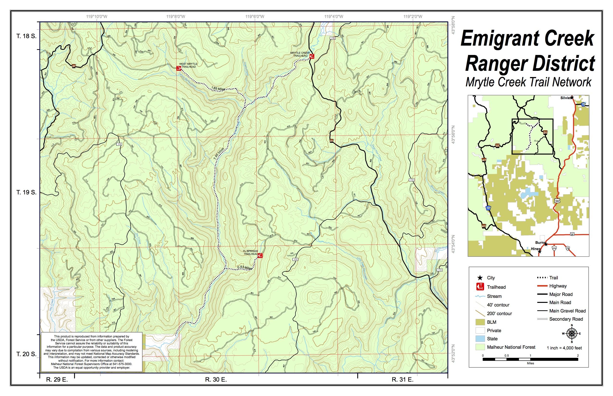
Mountain Biking Myrtle Creek / Trail #308
#256 of 306 mountain bike trails in Oregon
This trail follows along Myrtle Creek through a pretty, gentle river canyon with ponderosa pine and creekside vegetation. One way trail ends at private land. Must go down and back. via fs.usda.gov
First added by Jeff Barber on Oct 6, 2014. Last updated Apr 28, 2020. → add an update
Before you go
- Drinking water: unknown
- Drinking water: unknown
- Lift service: unknown
- Lift service: unknown
- Night riding: unknown
- Night riding: unknown
- Pump track: unknown
- Pump track: unknown
- Restrooms: unknown
- Restrooms: unknown
- Fat bike grooming: unknown
- Fat bike grooming: unknown
- E-bikes allowed: unknown
- E-bikes allowed: unknown
- Fee required: unknown
- Fee required: unknown
This trail information is user-generated. Help improve this information by suggesting a correction.
From Burns, travel north on US Highway 395 approximately 16 miles to Forest Service road 31. Travel 15 miles west on the 31 road to Forest Service road 3100226. The trailhead is located at the edge of the road.


Loading reviews...View more