×

|
Rate it:
Tags:
Level: Beginner
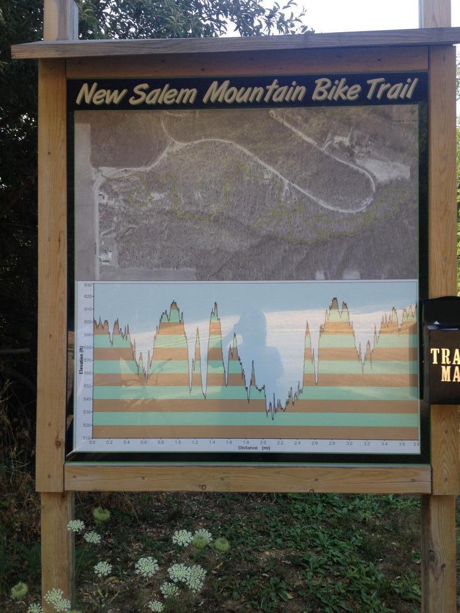
Length: 4 mi (6.4 km)
Surface: Singletrack
Configuration: Lariat
Elevation: +0/ -106 ft
Total: 15 riders
Mountain Biking New Salem
#49 of 128 mountain bike trails in Illinois
Designed by Tim Guinan and built in the summer of 2009 by seasonal workers, the 3.8-mile single-track trail is challenging, scenic and physically demanding. There are some very steep climbs, and you’ll get dirty.
The trail begins on a low grade, winding through autumn olive shrubs and a shady, hardwood forest canopy that provides food and cover for wildlife and at one point skirts the Sangamon River. There are sharp elevations and descents and two stream crossings along the way.
First added by ecruz1505 on Jul 15, 2012. Last updated Apr 28, 2020. → add an update
Before you go
- Drinking water: unknown
- Lift service: unknown
- Night riding: unknown
- Pump track: unknown
- Restrooms: unknown
- Fat bike grooming: unknown
- E-bikes allowed: unknown
- Fee required: unknown
This trail information is user-generated. Help improve this information by suggesting a correction.
The trailhead is on Coal Mine Road between Pritchetville Road and Boy Scout Trail on the east side of Illinois 97, across from the entrance to New Salem.
Coming from Springfield, make a right into Pritchetville Road (across from the
entrance to New Salem park). Veer right pass the parking lot. Make a right onto Coal Mine Road.


Loading reviews...View more