×

|
Rate it:
Tags:
Level: Beginner
Length: 3 mi (4.8 km)
Surface: Singletrack
Configuration: Network
Elevation: +33/ -58 ft
Total: 50 riders
Mountain Biking Jackson Bluff Trail System
#26 of 115 mountain bike trails in South Carolina
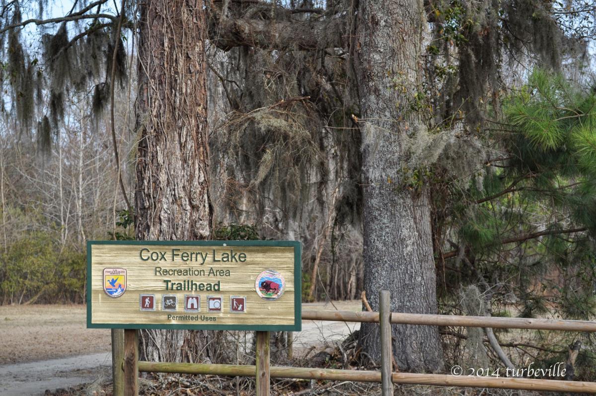
Great new trail on the Waccamaw National Wildlife Refuge. Trail ends up at the
Cox Ferry Recreation Area with a covered picnic and kayak launch area. It has a
combination of singletrack, doubletrack, and fire road. The singletrack trail, just
built with the help of IMBA, is technical and demands your attention and focus.
Doubletrack and fire road is fast and smooth. Beautiful new wooden bridge on
the main trail. Riding the trail from the trailhead to the recreation area and back
will get you a 6.2 mile ride. Trails are marked with Blue, Yellow, Orange, and
Green diamonds. Visit the website at http://www.waccamawtrailblazers.com/.
First added by gtc88 on Aug 6, 2010. Last updated May 11, 2020. → add an update
Before you go
- Drinking water: unknown
- Lift service: unknown
- Night riding: unknown
- Pump track: unknown
- Restrooms: unknown
- Fat bike grooming: unknown
- E-bikes allowed: unknown
- Fee required: unknown
This trail information is user-generated. Help improve this information by suggesting a correction.
From Conway on Highway 501:
Take Highway 544 South 1.6 miles toward Surfside Beach. Turn right on
Jackson Bluff Road at Gullies Shell gas station. Drive past Grand Strand Water
and Sewer. Continue straight past the water retention ponds on the left. You
will see a sign that reads " End of State Road Maintenance." Drive straight and
the pavement will begin to get a little rough. Go past the creek and look for the
trailhead entrance and parking area on the left.
From Surfside Beach 544 Exit off of 17 Bypass :
Take Highway 544 North 10 miles toward Conway. Turn left on Jackson Bluff
Road at the Gullies Shell gas station. Drive past Grand Strand Water and Sewer.
Continue straight past the water retention ponds on the left. You will see a sign
that reads " End of State Road Maintenance." Drive straight and the pavement
will begin to get a little rough. Go past the creek and look for the trailhead
entrance and parking area on the left.


Loading reviews...View more