×

|
Rate it:
Tags:
Level: Intermediate
Length: 23 mi (37 km)
Surface: Singletrack
Configuration: Out & Back
Elevation: +966/ -906 ft
Total: 8 riders
Mountain Biking Glenwood Horse Trail: Northern End
#155 of 300 mountain bike trails in Virginia
This section of the Glenwood Horse Trail travels through the national forest, dwindling in width from well kept double track to challenging single track as you progress southwards.
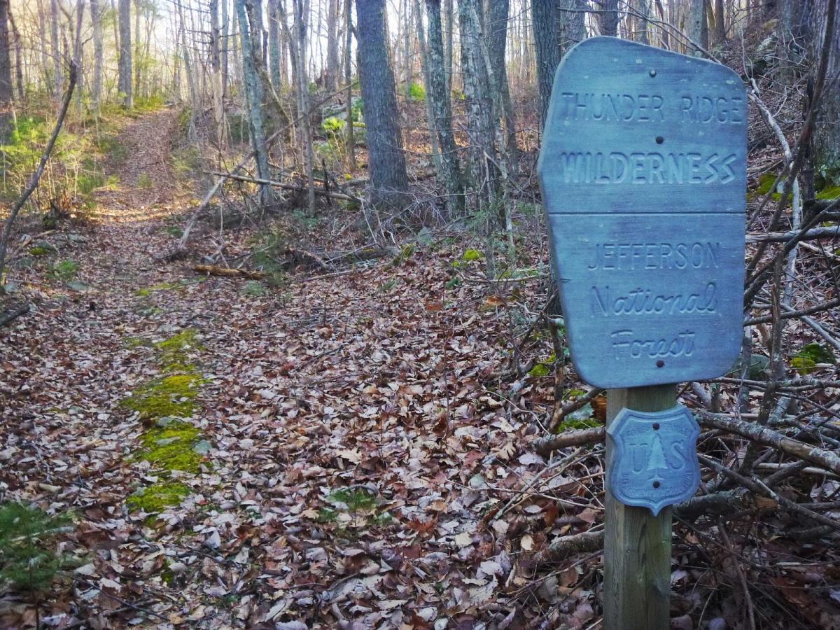
You can access Hellgate Horse Trail from Locher Tract. Glenwood Horse Trail picks up where Hellgate ends. Bikes are not allowed in the Thunder Ridge Wilderness Area, so take Petites Gap road if you want to reach the Blue Ridge Parkway, where the GHT exits the wilderness area and bikes are again permitted.
First added by John Robertson on Jan 13, 2014. Last updated Apr 28, 2020. → add an update
Before you go
- Drinking water: unknown
- Lift service: unknown
- Night riding: unknown
- Pump track: unknown
- Restrooms: yes
- Fat bike grooming: unknown
- E-bikes allowed: unknown
- Fee required: unknown
This trail information is user-generated. Help improve this information by suggesting a correction.
From I-81, take exit 180 to route 11 south.
Turn left onto route 130.
Turn right onto Arnolds Valley Road.
Turn left onto James River Road.
The road ends at Locher Tract.


Loading reviews...View more