Copper Basin Trail 3: Poormans Gulch trail photo
See all photos (3)
×
User
Today
 
  |   Rate it:

Tags:
Level: Intermediate
Length: 10 mi (16.1 km)
Surface: Singletrack
Configuration: Loop
Elevation: +724/ -717 ft
Total: 3 riders
 

Mountain Biking Copper Basin Trail 3: Poormans Gulch

****   Add a review
#42 of 108 mountain bike trails in Nevada
#7,578 in the world

Length: 10.4 miles
Total Elevation Gain: 1550 feet
Overall Skill Level: More Difficult
Trail Type Distances:
10 mi. single track
.4 mi. 2-track

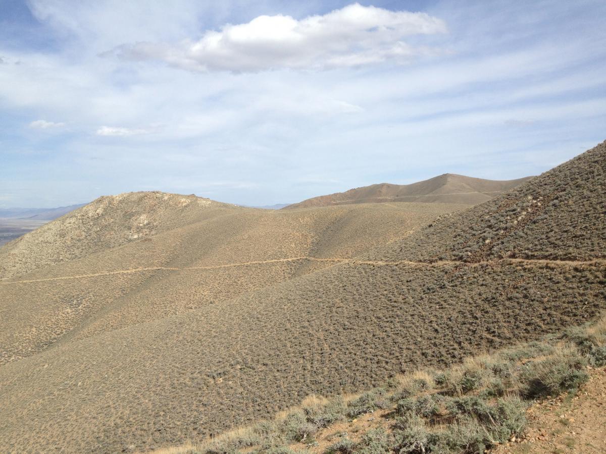
The Poormans Gulch loop is the longest of the three loops. Trail 3 is located off
the Dill Canyon (Trail 1) loop approximately 1 mile from the trail head. When Trail
1 takes a turn west continue across a road onto the Poormans Gulch Trail. For the
next 6 miles the single track trail snakes through sagebrush and in and out of
washes. The trail becomes increasingly difficult as the elevation increases. After
passing some small ponds with thick brush and an old homestead the trail
continues north up to a road (2-track) where a Carsonite sign will direct you left
on the 2-track. Follow the road around and up to a saddle. When reaching the
saddle you see stunning views of Battle Mountain and the Mesa across the valley.
Follow the 2-track down about 0.1 of a mile. The approximately 4 miles of
downhill take off on a single track trail to your right, marked with a sign. Enjoy the
scenic downhill trail as it traces the topography of the hills. Follow the trail down
to the Limestone Wash Trail where it intersects near an old mine site. Ride the
Trail 2 loop clockwise to reach the trail head. This trail has the most difficult route
finding of the network. Any major turns on/off roads will be marked with Carsonite
Signs. On trail route finding is marked with orange flagging. Enjoy!

First added by jrussette on Sep 6, 2011. Last updated May 11, 2020. → add an update
Before you go
  • Drinking water: unknown
  • Lift service: unknown
  • Night riding: unknown
  • Pump track: unknown
  • Restrooms: unknown
  • Fat bike grooming: unknown
  • E-bikes allowed: unknown
  • Fee required: unknown
This trail information is user-generated. Help improve this information by suggesting a correction.
Getting there
The Copper Basin Bike Trailhead:

Is located on HWY 305 about 2.75 miles south Battle Mountain and I-80. The
trailhead is on the west side of HWY 305 just as you reach the hills. The trail
system is marked with orange flagging and brown Carsonite Signs. The loops
offer a variety of technical and aerobic challenges on a combination of single and
double track trails. Steep Climbs and fast technical descents wind through historic
mining areas, sagebrush covered canyons, and rocky ridge tops in the northern
Battle Mountain Range. Enjoy the trails for a quick 1-hour ride or a weekend long
adventure! Remember to prepare for the heat during summer months by riding at
dusk and dawn and bringing plenty of water.


Copper Basin Trail 3: Poormans Gulch Trail map

Add to or improve this map // Share this map on your website

Local Info

Club Sponsor

-

Local Bike Shop

-

Trail checkins

Upcoming Events

None.
Add one

Trail conditions

Dusty (on Jun 15, 2013)
login to update

Camping & Lodging

Coming soon!

Copper Basin Trail 3: Poormans Gulch videos

Add a video
We don't have any videos of this trail yet. Add one here.

Mountain Bike Trails Near Battle Mountain, Nevada

| 6 mi
| 8 mi
| 5 mi

Add a review

Rating
 
Difficulty
 
Review

Reviews

    Loading reviews...

Rider questions