×

|
Rate it:
Tags:
Level:
Length: 12 mi (19.3 km)
Surface: Doubletrack
Configuration: Out & Back
Elevation: +566/ -607 ft
Total: 3 riders
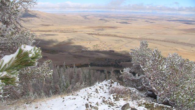
Mountain Biking Centennial Ridge
#171 of 252 mountain bike trails in Wyoming
This ride consists mostly of old Forest Service roads most of which are rocky, rutted, and rough. The ride climbs about 1300 feet right away as the roads get more and more primitive with each turn. Finally at the top there are incredible views in all directions. The ride out to the Queen Mine is optional but worth it and the old two track is very fun, fast rolling with waterbar jumps. The ride down has two nice diversions on very old abandoned roads.
First added by bonjarno on Oct 6, 2012. Last updated Apr 28, 2020. → add an update
Before you go
- Drinking water: unknown
- Lift service: unknown
- Night riding: yes
- Pump track: unknown
- Restrooms: unknown
- Fat bike grooming: unknown
- E-bikes allowed: unknown
- Fee required: unknown
This trail information is user-generated. Help improve this information by suggesting a correction.
On Wyoming Highway 130 approximately 28.5 miles west of Laramie there is a USDA Forest Service Visitor Center on the right side heading west. Park there. The ride begins on FS 338 which is directly across the highway from the Visitor Center.


Loading reviews...View more