×

|
Rate it:
Tags:
Level: Expert
Length: 8.1 mi (13 km)
Surface: Singletrack
Configuration: Network
Elevation: +142/ -144 ft
Total: 1 riders
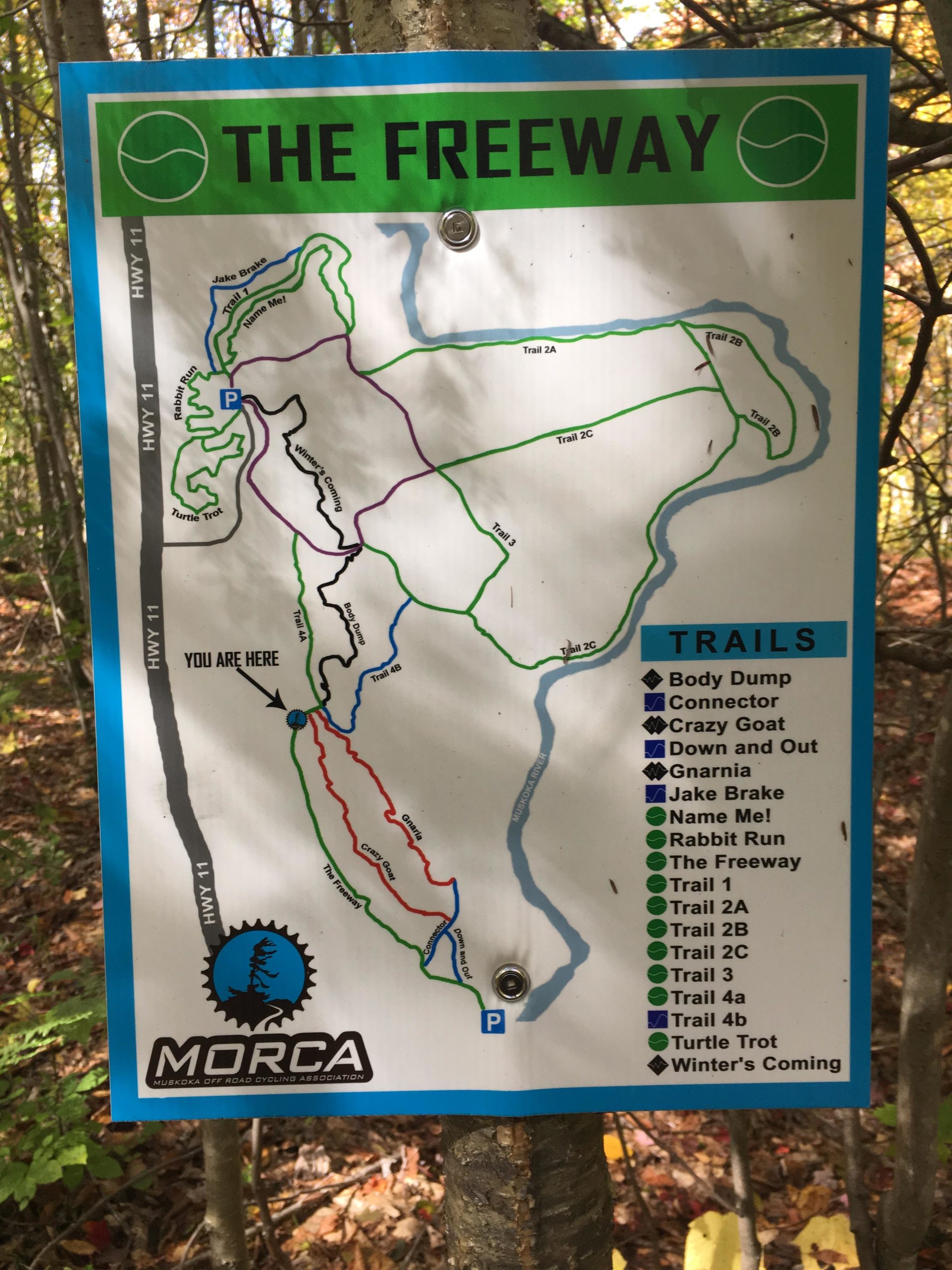
Mountain Biking Bracebridge Resource Management Centre
#147 of 312 mountain bike trails in Ontario
Opened in 2019 with trails including The Freeway, Rabbit Run, and Winter's Coming. Created and maintained by Muskoka Off-Road Cycling Association (MORCA).
First added by Jeff Barber on May 13, 2019. Last updated Apr 17, 2020. → add an update
Before you go
- Drinking water: unknown
- Lift service: unknown
- Night riding: unknown
- Pump track: unknown
- Restrooms: unknown
- Fat bike grooming: yes
- E-bikes allowed: unknown
- Fee required: unknown
This trail information is user-generated. Help improve this information by suggesting a correction.
Access from the northbound lane of Hwy 11, north of the Cedar Lane exit.


Loading reviews...View more