×

|
Rate it:
Tags:
Level: Beginner
Length: 16 mi (25.7 km)
Surface: Doubletrack
Configuration: Network
Elevation: +107/ -71 ft
Total: 13 riders
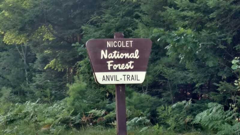
Mountain Biking Anvil Trails
#102 of 389 mountain bike trails in Wisconsin
Desolate, rugged, and enclosed by pines on all sides; and in this case enclosed by water. Paths cover a wide variety of surfaces, from wide doubletrack paths on the West and North trails, to narrow cross-country ski paths on the Ninemile and Lake trails, to rough and challenging singletrack on Devil’s Run.
First added by ninseinightgrl on May 10, 2010. Last updated Apr 28, 2020. → add an update
Before you go
- Drinking water: unknown
- Lift service: unknown
- Night riding: unknown
- Pump track: unknown
- Restrooms: unknown
- Fat bike grooming: unknown
- E-bikes allowed: unknown
- Fee required: unknown
This trail information is user-generated. Help improve this information by suggesting a correction.
From Eagle River, take State Highway 70 east for 9 miles to Parking Lot #1 on right (south), which can accommodate 20 vehicles. Or take State Highway 70 east 8 miles to Military Road (FR 2178), and turn right (south) to Parking Lot #2 on the left (east), which can accommodate 12 vehicles.


Loading reviews...View more