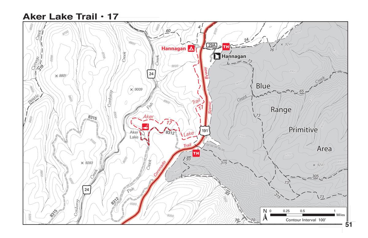
The Aker Lake Trail drops gradually 400 feet over its 3.5 mile span to Aker Lake. The trail passes through a mixed forest area of aspens and conifers.
This trail is open to non-motorized uses including mountain biking, hiking, and horseback riding.
Songbirds can often be heard when riding quietly and slowly. As you continue your ride, you'll come to a meadow called Butterfly Cienega and once you ride along the meadow, you will reenter the forest. This may also allow a rider to catch a glimpse of the area's wildlife including elk, mule deer, or even black bears. From the forest, you'll renter the valley and follow the trails as it brings you to Aker Lake where you will cross a log bridge across the dam. You can loop this trail by following Aker Lake Road (FR 8312) back to Butterfly Cienega and retracing your route from the meadow.
This trail is here for your enjoyment due in large part to volunteer Don Yates. Yates worked as a campground host at the nearby campground and planned and constructed this trail over a three year period.quietly and slowly. As you continue your ride, you'll come to a meadow called Butterfly Cienega and once you ride along the meadow, you will reenter the forest. This may also allow a rider to catch a glimpse of the area's wildlife including elk, mule deer, or even black bears. From the forest, you'll renter the valley and follow the trails as it brings you to Aker Lake where you will cross a log bridge across the dam. You can loop this trail by following Aker Lake Road (FR 8312) back to Butterfly Cienega and retracing your route from the meadow. source: fs.usda.gov
Loading reviews...View more