×

|
Rate it:
Tags:
Level: Expert
Length: 3 mi (4.8 km)
Surface: Singletrack
Configuration: Out & Back
Elevation: +1,058/ -1,025 ft
Total: 9 riders
Mountain Biking Kealia Trail
#4 of 33 mountain bike trails in Hawaii
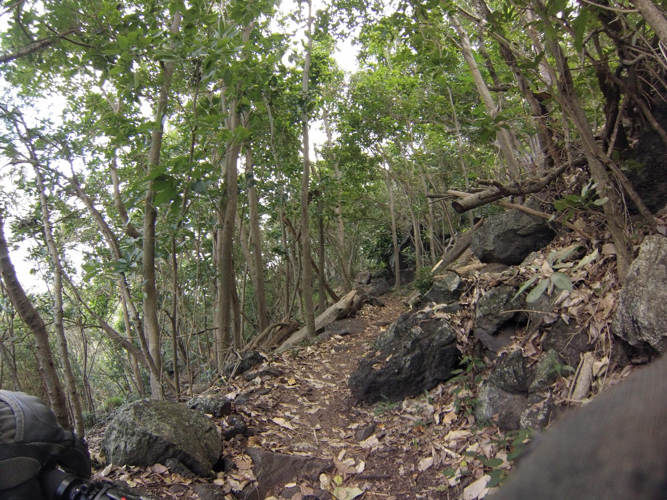
This particular trail is an out and back. It does link up with Peacock Flats at the top, where you will find a picnic table and covering, however this is an individual trail. Out and back is 3.4 miles. You will have to hike/climb up much of it if you go this route. Usually we park at Dilingham Field and then ride out to Peacock Flats and take Kealia down. The trail is very rocky, packed dirt, some tight sections with trees and large boulders/rocks, tight switchbacks, a few areas to get air if you want, great scenic views, and downright fun. (Quoted form mtbhawaii.com "Kealia is switchback after switchback down the side of a cliff face. Steep, rocky, sharp corners with drop offs. Know your limits and walk if you need too. Kealia Trail is a gem, some of the best technical single track on the island. You will get to the bottom and look back up at the mountain and think, "How did I just ride down that!")
This is about as true as it gets. A must ride!
First added by GTXC4 on Apr 13, 2014. Last updated Apr 28, 2020. → add an update
Before you go
- Drinking water: unknown
- Lift service: unknown
- Night riding: unknown
- Pump track: unknown
- Restrooms: unknown
- Fat bike grooming: unknown
- E-bikes allowed: unknown
- Fee required: unknown
This trail information is user-generated. Help improve this information by suggesting a correction.
From Honolulu take H1 West/North toward Aiea then connect to H2 to Wahiawa/Schofield Barracks. H2 will end and turn into Wilikina Dr and follow it North. Stay left at the fork going under the over pass. You will soon be on Koukonahua Rd. Follow this and stay straight which will eventually turn into Farrington Rd. Follow it down unit you see Dilingham Airfield on the left and just after the airfield you will see a gate with a road, take a left onto the road through the gate and follow it to the parking lot behind the Control Tower. Parking here will be fine. Take the dirt road toward the mountain and then make left on the dirt road and follow it until you see the sign for Kealia Trail.
Featured in


Loading reviews...View more