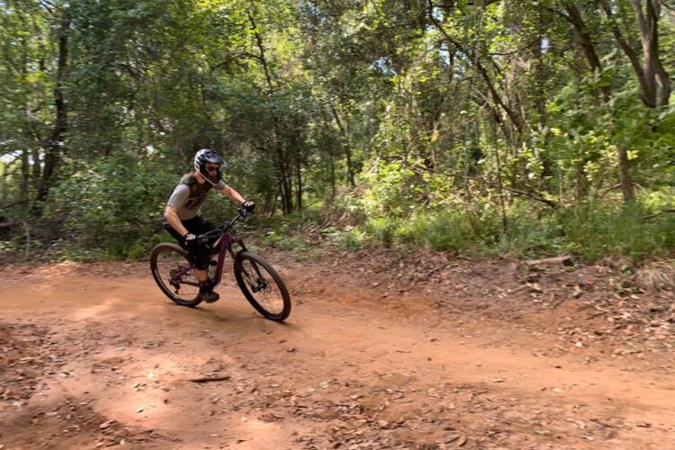
One bright and beautiful September afternoon roughly a decade ago, I was riding with a colleague, having a grand time slaying singletrack and swapping ride stories. At one point, as I recounted a rather spectacular endo, my colleague informed me he had never gone OTB. I found this a little hard to take. After all, I had only been riding about five years and had already done at least that many Superman impressions; he, on the other hand had about two decades more than me in the saddle. Yet, he swore this was the truth. In fact, all his stories were just about great rides; no disasters. Other than the great endo story I was trying to put into words, (to be honest, you kinda had to be there), I did have a couple stories of somewhat greater peril, and as it turns out, more were to come.
They say we (should) learn from our mistakes. I have always preferred to learn from others’ mistakes and not make them myself in the first place. However, it hasn’t always gone that way in my mountain biking past. It is, no doubt, much the same for most riders; few have nothing embarrassing in their riding past. The best most of us can do is share our perils so that others may (hopefully) learn from them. Here’s a brief recount of three bad situations I got myself into.
Bad Trip #1
The Venue: Steamboat Springs, Colorado
Experience Level: 1 Year Riding
The Plan: Ride from Rabbit Ears Pass to Buffalo Pass and back by combining various trails
The Difficulty: LOST!
How it Went Down:
After an 0400 rise-and-shine followed by a three-hour drive from my home in Cheyenne, Wyoming, through a collection of mountain roads toward Steamboat Springs, Colorado, I arrived at the Rabbit Ears Pass trailhead more than a little fatigued. 0400 is very early, and I’m most definitely not a morning person. Add to that a long drive over winding mountain roads, mostly in the dark, and with very heavy eyelids, and I was in no shape to be putting in 40 miles of singletrack riding at 10,000 feet in elevation.

Nevertheless, I made my way out the Continental Divide Trail, eventually hooking up with the Base Camp Trail and lastly the Wyoming Trail, ultimately arriving at Buffalo Pass, about 20 miles afield from my start. The trail was nice, the woods were welcoming, the weather good, route finding easy, and I reached my destination feeling refreshed and quite pleased with myself for executing the journey so efficiently. Knowing I had that far to go back and another three-hour drive home awaiting, I turned around without tarrying too long, and made my way for Rabbit Ears Pass and my awaiting truck.
Not wanting to do a straight out-and-back, I found a trail route that would give me a partial loop, finishing with a lollipop stem to the truck.
Where Things Went Wrong:
I took the alternate route back, but as I approached what I believed to be the intersection with the stem, I noticed not one, but two options. I was rather perplexed. Which one to take? About 30 miles into a 40-mile day, I was faced with a dilemma, and my mind wasn’t as sharp as it was 10 miles previous when I departed Rabbit Ears Pass. As you have certainly deduced by now, I took the wrong fork. It sure looked like it went the right way!
After about an hour of wandering in the woods, I knew I had erred. I had lost a lot of time and was too stubborn to turn back, thinking I could find my way out more efficiently. After all, I could read a map, I had a compass. What a perfect way to put my Eagle Scout training to the test.
But there were two great flaws in that theory.
First, the woods were very dense and there was no way to see through to any landmarks from which to take a compass reading. Second, even when there were openings, they were now obscured by a heavy fog which had rolled in. The skies were thick and grey, constantly misting. Despite being late August, the temperature had dropped to the low 50s, maybe even the 40s, and the dampness of the fog and mist made for perfect conditions for hypothermia. Fortunately, I have a world class internal furnace, and have never been threatened by cold, which came in very handy at this time.

So once I had myself irretrievably lost, I began calling out. Ride a quarter of a mile and holler for any human who might be in the area and know where the h-e-double toothpicks we might be. Ride another quarter mile and try again. And again.
Nobody.
Between looking over my shoulder in the darkening mist for bears, mountain lions, wolves, wolverines, deranged mountain men, Yetis (abominable snowmen, not bikes), Sasquatches, and Orcs, I would pull out the map from time in an utterly futile attempt to relocate my position. Ride, read, holler, fail. The pattern repeated itself ad infinitum. As darkness approached and I actually started to worry, being utterly, hopelessly lost and having long since run out of both food and water, I came around a corner and saw a break in the clouds. Hallelujah! I could see a mountain top. Surely I could figure out what summit it was by comparing terrain to my topo map and thus find a way home!
But I didn’t even need the map. As the mist cleared further, I could see a ski lift ascending the mountain. It was Mt. Werner, the main massif that makes up most of the Steamboat ski area. The good news is I knew exactly where I was, having skied there many times in the winter. The bad news is that I was nowhere near where I wanted to be. Even if I knew how, there wasn’t enough daylight remaining for me to get there. And even that would require I had the energy reserves to make the journey, which I did not.

So I did the only thing I could do. I pointed my trusty old hardtail down the mountain and bombed my way into the town of Steamboat Springs. There was no way I could ride the 3,000 vertical feet back up to my truck at the summit of Rabbit Ears Pass, so, I inquired as to cab service, preferably one with room for a bike. Having left my wallet in my car, I had to beg a convenience store for them to let me use their phone, then beg the cabbie to trust me that there was indeed a wallet at the top of the hill. Cab rides aren’t cheap, especially in mountain towns–but that was the best $50 I ever spent!
Lessons Learned:
- Build up gradually. Don’t jump directly from 12-mile rides in familiar territory to 40-mile rides in unfamiliar backcountry.
- Maintain a fix on your position. If proceeding into unfamiliar territory, make regular stops to ensure you haven’t gone the wrong way. Don’t dive deeper and deeper into the unfamiliar territory, hoping it will get better. “Hope is not a plan!”
- If lost, backtrack to a known location! (I already knew this.)
- Keep your wallet/money/credit cards on you, especially when going back into the bush.
- Overconfidence kills.
- Prepare for the weather! (I also already knew this.)
- If you’re really pushing it, ride with a partner.
Click to page 2 for yet another epicly bad trip!