Trails
Gear
Community
Tips
Deals
Latest
Support
Trails
Find trails
Best bike trails
Destinations
Trail news
Add a new trail
Gear
Mountain bike reviews
Components
Tires
Clothing & shoes
Helmets
Accessories
Repair
Product news
Community
Forums
MTB Clubs
Races & Events
Bike Shops
Tips
Skills
Fitness & Training
Health & Nutrition
Beginners
Repair
Latest Articles
Podcast
Deals
Support Singletracks
Sign in
Create an account
Merch
About us
Newsletter signup
Home
/
Mountain Bikes and Gear
/
Accessories
/
Electronics
/
GPS
GPS
Bikepacking
The Key Tech Developments that Made Bikepacking Easier... And More Fun
news
Garmin Brings Solar Charging to More Affordable GPS Models
Bikepacking
Cyclists Made Fewer SOS Calls Than Hikers, Climbers with Garmin InReach
podcast
He Works to Give Bikepacking Racers More Visibility... And to Keep Them Honest Too
Giant
Giant Dash M200 GPS Looks Good but It's Still a Work in Progress [Review]
GPS
Lezyne Super Pro GPS is a Good Choice for Trail Riders [Review]
GPS
I Think We've Been Here Before. Reviewing the Bryton Rider S500 GPS
GPS
The Garmin Edge 530 GPS Gives Mountain Bikers Tools for Progression [Review]
GPS
Hammerhead Karoo 2 Bike GPS Review
GPS
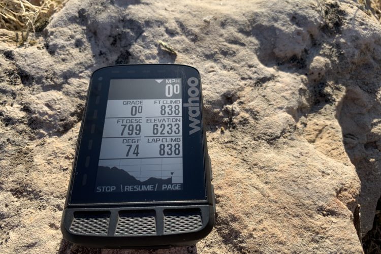
GPS Accuracy Test, Round 3: How to Improve Trail Distance and Elevation Tracking Accuracy
budget
The Bryton Rider Neo 15 GPS Costs $70, Features a Smartphone Connection [Review]
news
Wahoo Elemnt Bolt GPS Gets Color Screen, More Memory for Maps [Review]
Wahoo Introduces Fitness Tracking GPS Watch
Today Wahoo announces their first wrist-mounted GPS device, the $379 ELEMNT RIVAL.
TMYK: How to View Bike Trail Maps on Your GPS Device or Smartphone App
Download free trail maps using your smartphone, and transfer them to a GPS device wirelessly for easy navigation.
How do You Track MTB Ride Distance and Speed? [Survey]
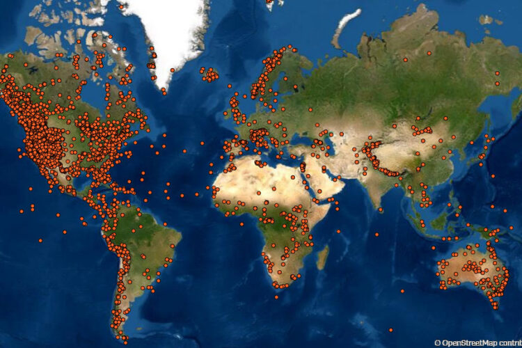
For many of us, if there isn't a GPS trace to save at the end of the ride, it's as if it didn't happen.
Garmin Fitness Services are (Mostly) Back Online After Extended Outage
According to the Garmin System Status page, many of the company's online services are back online as of today, though some features mountain bikers rely on are not fully operational.
Polar Has an Affordable new Multisport Watch to Track the Trails and Your Heart Rate
The Unite looks like a cool option for riders who want to record their ride and heart rate, without other confusing functions.
Track Your Hangtime and Adventures with new Garmin Edge 130 Plus and Edge 1030 Plus Cycling Computers
These new cycling computers from Garmin track your air time and trail flow score for mountain biking.
The Wahoo Elemnt Roam is Customizable and More MTB Friendly than Before [Review]
The Wahoo Elemnt Roam adds a color screen, greater usability with mountain bike maps, and other new functions in the newest edition.
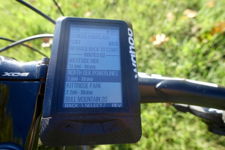
New! Get Singletracks Trail Maps on Your Wahoo GPS
Link your Singletracks and Wahoo accounts to get free mountain bike trail routes on your GPS.
Review: Wahoo Elemnt GPS Looks Basic, But Packs Killer MTB Features
The Wahoo Elemnt cycling GPS is dead simple to use, yet packed with features mountain bikers will find very useful.
"Do GPS Units Always Overestimate Trail Distances?" No.
While the "GPS always overestimates distances" camp is fairly vocal, there's an equally vocal camp that argues the opposite.
more articles