


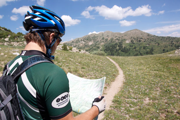
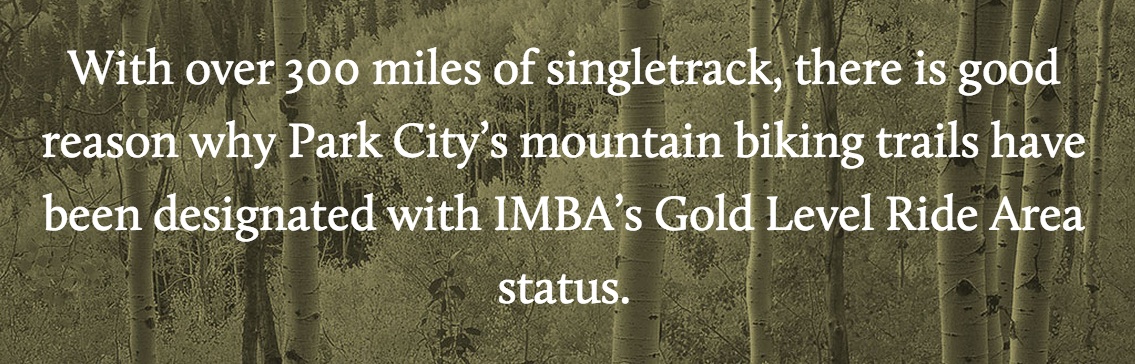
If there’s one thing that any mountain bike marketer or writer worth his salt loves to do, it’s to bandy about big statistics that work great as a sound bite or an advertisement. We see this all the time with major mountain bike destinations. Park City, Utah boasts “over 300 miles of singletrack…” or 400, depending on the source. Winter park claims “600 miles of mountain bike trails.” Steamboat Springs professes to have “hundreds of miles of singletrack” or “more miles of singletrack mountain biking than anywhere in North America (576),” depending on which website you check. But yet other destinations, like Crested Butte and Moab, just don’t give a rip what you think the actual number is, because it’s so dang high that they’ve run out of fingers for the hundreds.
The problem with these stats is that there’s no solid definition of what that number actually means. Every destination arrives at their statistic in a different way. There are plenty of choices that muddy the water: What sort of paths should be included: singletrack, doubletrack, dirt roads? What should the radius distance from the town center be? Where should the data be drawn from?
After reading an article in a major mountain bike magazine that says “El Paso has 135-plus miles of dirt roads and trails that are almost all inside, or easily reached from within, city limits,” I realized that something needs to give. 135 miles of singletrack and dirt roads… really? If he had said “70 miles of singletrack” I might have been impressed, but the way this is written El Paso could just as easily have 5 miles of singletrack and 130 miles of dirt roads!
Throughout the rest of this article I will argue for a more standardized approach to attaining a respectable stat for trail mileage in a given destination.
What counts as a trail?
First, we need to get one thing clear: what, exactly, counts as a “mountain bike trail?” For the purposes of determining the quality of a mountain bike destination, everyone needs to get one thing straight: dirt roads do not count as trails. While we do catalogue dirt roads in the Singletracks database, those listings exist primarily as a resource for the locals. If you’re coming from out of town to ride, who in their right mind would waste their time pedaling a rutted out 4×4 path if they could be shredding sweet singletrack? The only reason to ride a dirt road when you’re on a mountain biking vacation is to get to some sweet singletrack.

Secondly, only legal trails should be counted. Every destination worth its salt has certain underground trails that probably shouldn’t exist, and those definitely should not be factored in when trying to attract tourism. The first rule of riding illicit singletrack: keep your mouth shut!
Third, do you include doubletrack trails? Now this is a sticky situation, since doubletrack can sometimes be great for making a mountain bike connection… but I’d advocate against including it in the overall number. Doubletrack still isn’t what most mountain bikers are after, and if on the off chance there’s a newbie rider visiting a destination that does want to ride doubletrack, it’s easy to come by. Singletrack, on the other hand, can be oh-so-rare.
When rattling off a number touting the massive amount of trail mileage, I think marketers and writers need to be more up front about what we’re actually discussing, and break the stat down a bit. Sure, it might not be as catchy, but at least it’ll be honest. If there’s 200 miles of bike-legal singletrack and 400 miles of dirt roads, then just say so! And if you want to be as pithy as possible, just take Park City’s approach and claim “X miles of singletrack mountain bike trails.” Then, even if your number isn’t huge, at least riders will know that you’re talking about the real deal.
How close does a trail have to be to qualify as a part of your town/destination?
Choosing the radius that qualifies as your “town” is an arbitrary selection at best. In some locations, such as Steamboat Springs, there isn’t another major town for hours, so it’s pretty easy to claim anything and everything as “Steamboat.” However, the radii around many destinations bump up against the bubbles surrounding other nearby towns, so how do you determine what counts as your “town?”
As I said, while this is rather arbitrary, if you have intimate knowledge of the region, I’d suggest one of three ways to pin down the exact geographical area:
- If there’s a major geographical division, then use that to determine the area. For instance, Crested Butte is separated from the town of Aspen by a major mountain range that’s only passable by bike or a legit 4×4 vehicle. It’s pretty easy to figure out which trails belong to Crested Butte, and which belong to Aspen.
- Go until you hit another town of equal or greater size. In remote areas, there might not be another major town for a hundred miles! If not, it wouldn’t be unreasonable to assume that everything that’s closer to your town than it is to the next town over counts as singletrack in ABC destination.
- Include all trails within easy driving distance from your town. Driving about 45 minutes one-way for an epic mountain bike ride is really no big deal. However, once you pass the hour mark, you really need to ask yourself if it’s worth it for a day trip, or if you should pick up and move your base camp to a different area. While perhaps the amount of distance riders would be willing to drive depends on the location in question (see #2 above), I suggest no more than a 45-60 minute driving window.

Where do you collect the data from?
Depending on the land managers, how big the radius that you’ve decided upon is, and what you consider to be a mountain bike trail, simply assembling the data can be a daunting task. The marketer or writer might need to consult a plethora of maps, many of which might not even have official mileage stats listed on them. Then, if some trails have been decommissioned or if new trails have been built or rerouted since the map was last updated, those need to be factored in.
Ultimately, the only truly accurate way to decide upon the distance would be to ride all the trails with an accurate bike computer and keep detailed spreadsheets cataloguing the results, but for most of the destinations we’re discussing, riding every single one of the trails could be a lifetime’s work!

My Experiment
I’ve never heard anyone mention a reputable stat for total trail mileage in the Salida area. And since I have an ego the size of Mount Princeton (or maybe I just like statistics…), I really wanted to find out how our sheer amount of trail mileage measures up against other better-known destinations.
Here are the criteria I decided upon:
- Trail Type: Bike-legal singletrack trails. However, unlike the Park City area, many of our best singletrack trails are motorcyle-legal, so I’m including those in my calculation. However, I’m only including moto-legal trails that are marked as prohibiting ATVs, so that they’re most likely singletrack.
- Radius: Using my knowledge of the local area, I’m counting trails that can be accessed by a drive of roughly 45 minutes or less. However, since a number of long-distance trails run through Salida, I’ll only be counting reasonably-accessible portions, and not all 500 miles of the Colorado Trail (for instance).
- Data Sources: The Latitude 40 Salida/Buena Vista trail map, the Rio Grande National Forest trail map, and one small estimate for a largely unmapped area to the east. (Note: if anything, that estimate will be low, not high.
After over an hour of pouring over maps and adding trail lengths into a spreadsheet, I’ve calculated that we have 460+ miles of bike-legal singletrack trails in the Salida area that meet the above criteria. Factoring in doubletrack trails that aren’t rated for jeep or car usage adds another 60+ miles and there are, quite literally, thousands of miles of dirt two wheel drive and 4×4 roads in our town’s radius.
To be honest, that number was a couple hundred miles higher than even I expected it to be! I am pleasantly surprised by the wide variety of mountain biking opportunities available in our area.

Conclusion
Even with the semi-scientific approach I took above, there’s still plenty of room for human error and exaggeration. However, I think the moral of the story is that if you’re having a hard time deciding if a town has 400 or 500 miles of trails, it’s a moot point: that’s still more miles of singletrack than most people could explore in a year of riding! And if you’re only looking to plan a week-long getaway, you will undoubtedly have more trails on your to-do list than you’ll ever be able to shred.
Your Turn: Based on the criteria I’ve outlined in this article, how many miles of trails does YOUR town have?


