


The idea behind the Singletracks Brutal Loop was to put together a long route that hit as much great North Georgia singletrack as possible. When most people visit Ellijay, they typically ride Bear Creek and sections 1 and 2 of the Pinhoti Trail. Another excellent but less ridden trail is Mountaintown Creek. Mountaintown is tough to get to, it’s not really near anything else, but the payoff is a rugged descent and a legit backcountry feel.
What if you wanted to ride Bear Creek, Pinhoti 1 and 2, but also Mountaintown? Well, that’s what we sought to tackle with this loop. Seeing as how we are inviting folks up to Mulberry Gap to take part in this ride, we figured we’d better do it ourselves first! Here is the ride report from the pre ride.
The ride begins and ends at Mulberry Gap. Once you leave here you will be climbing for a long, long time: around 13 miles and 3,000 feet of vertical. It’s all on Forest Service roads, but there are some steep pitches. Luckily, there are a few places to stop, take in the view, and catch your breath. The first is Barnes Creek Falls, about 4 miles into the ride.
A little less than a mile later is the can’t-miss Bear Creek Overlook (mile 4.8). Here, you can see Fort Mountain to the south west.

From the Bear Creek Overlook you will continue climbing up the gravel road until it dead ends into FS 64 at Potato Patch (mile 6.4). Head right towards Jacks River and keep climbing.

FS 64 has some tough humps to get up and over, but thankfully they aren’t too long. You’ll also get a couple of ripping gravel descents. About 10 miles in, you’ll reach the Mountaintown Overlook, which is even more beautiful than the Bear Creek Overlook.
After 13 miles on gravel, you’ve earned the descent down the Mountaintown Creek trail! The beginning of the descent is steep, rugged, and has lots of water bars to launch off of. Some of them will blast you into the stratosphere if you aren’t careful, so keep your speed in check.

Since the trail is so remote, it doesn’t get much regular maintenance. On our ride there was a huge tree down about 2.5 miles from the road. So be careful!
Eventually, the trail mellows out and you will cross the creek about a dozen times. Some crossings are easily rideable, others require walking. The deepest was about up to our knees.
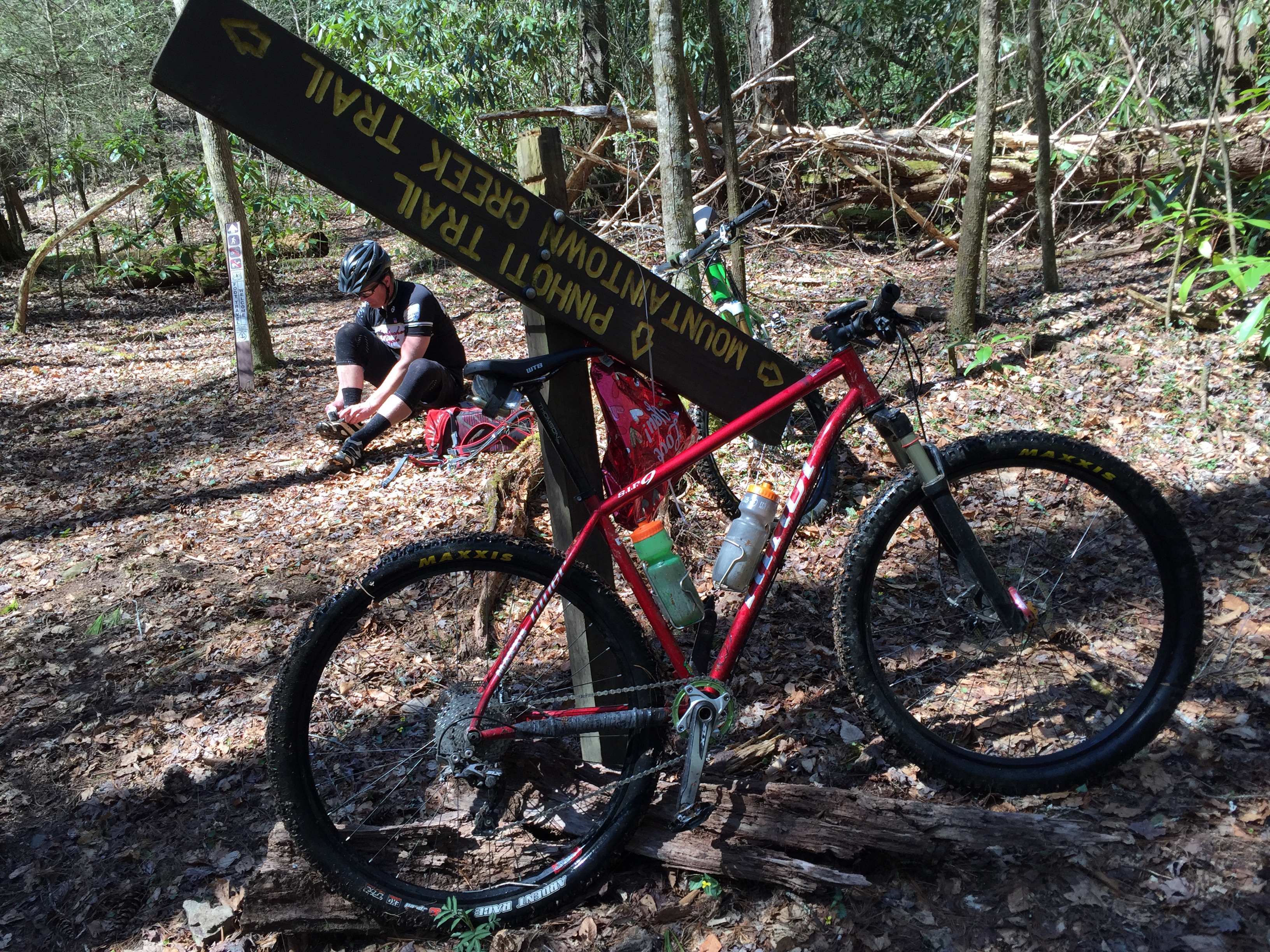
Just over 17 miles in, you’ll make a right turn onto the Pinhoti Trail. This section is hiking only. It’s steep going and you’ll have to carry your bike, but you’ll only be on it for just over a mile. The trail drops you out on the Bear Creek Loop gravel road, an old Forest Service road that has grown over. It’s shaded and the grades are pretty mellow. You’ll take this up to the top of the fantastic Bear Creek descent.
Update: The actual Brutal Loop route avoids the hiking-only trail, following the private gravel road out to Gates Chapel Road. After less than half a mile on the paved Gates Chapel Road, the route turns right onto FS Road 241 to the start of Pinhoti 1.
Pinhoti 1 has some steep, punchy climbs. At the end of Pinhoti 1, you’ll have a half-mile of gravel to get to Pinhoti 2. There will be a bit more climbing before you go tearing down the mountain. Pinhoti 2 dumps you out onto Lake Conasauga Road (gravel). Take a right and after about 1.5 miles of pedaling you’ll be back at Mulberry Gap!
This was a tough ride. I thought it would be closer to 40 miles, but it ended up being around 32. It’s not the miles, though… it’s all the climbing that will wear you out. Take your time, drink a lot, eat a lot, and just enjoy the day.

Stats:
- 32-34 miles (traces differed between phone and GPS)
- 6,000-7,000 feet of climbing (traces differed between phone and GPS)
- Most riders will require 4-6 hours of ride time to complete
Things to know:
- Be sure to sign up with Mulberry Gap so we know you’re coming.
- Reserve a campsite or cabin with Mulberry Gap if staying overnight, and pay in advance.
- Meals are available for purchase from Mulberry Gap; please pay in advance.
- Limited to 75 participants.
Cues (your mileage may vary):
- 0.0 LEFT out of Mulberry Gap
- 0.5 RIGHT on FS 68
- 3.2 LEFT stay on FS 68 towards Lake Conasauga
- 4.0 VIEW Barnes Creek Waterfall on right
- 4.8 VIEW Bear Creek Overlook
- 6.4 RIGHT on FS 64 towards Jacks River (Potato Patch)
- 10.2 VIEW Mountaintown Overlook
- 10.7 RIGHT stay on FS 64 to Blue Ridge
- 13.2 RIGHT onto Mountaintown Creek Trail (Will see Pinhoti turkey foot signs)
- 15.7 CAUTION! Tree down in middle of descent
- 17.2 RIGHT onto Pinhoti (This section is HIKING ONLY)
- 18.5 RIGHT onto Bear Creek Loop (Old forest service road)
- 20.2 Bear Creek Loop merges with FS 68 on the right
- LEFT thru the gate and downhill
- 22 VIEW Gennett Poplar on right
- 22.5 HARD RIGHT and uphill Pinhoti 1
- 26.2 LEFT onto Wilderness Road gravel
- 26.3 RIGHT onto gravel road
- 26.8 RIGHT onto Pinhoti 2 thru gate (Will see Pinhoti turkey foot signs)
- 30.4 RIGHT onto Conasauga Road (gravel)
- 32 LEFT into Mulberry Gap


