Albuquerque offers a diverse collection of mountain bike trails just a short drive from the city limits. As recently highlighted, both the Sandia foothills and the east side of the Sandia Mountains offer fast, flowing trails that mountain bikers of all levels can enjoy. The majority of these trails, however, are easy to moderate in technical difficulty, with only a couple of advanced options.
The trails in the Manzanita Mountains, however, are quite the opposite. The majority of the trails are rated intermediate to advanced, though occasionally you will reach open meadows, where the trails are smooth and relatively flat, offering a nice reprieve from the lung busting, white knuckle riding surrounding it.
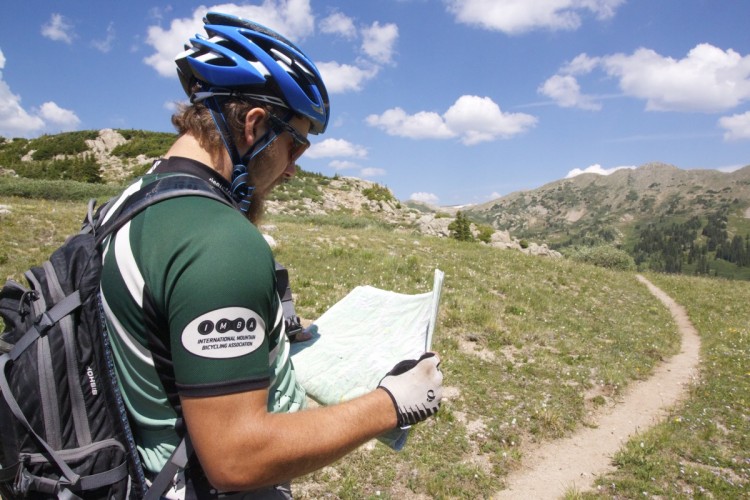
I have to start this trail review with a bit of caution. There are miles upon miles of trails. A good portion of the trails are very well kept and have excellent trail markers. There are also a fair number of trails that can take you deep into the desert woods, and even wind through the restricted (read: illegal to ride on) Kirtland Air Force base. Local lore has it that at one time there was sweet singletrack on national forest land, which was commandeered by the Air Force after 9/11. However, I don’t trust my luck or my skills of persuasion with trigger-happy 18-year-olds with M-16s. Additionally, I have known a couple of guys to spend a few extra unwanted hours on the trails due to being turned around. With that said, I highly recommend consulting the Singletracks maps or riding with a local. At the very least, swing by the ranger station or print out the National Forest Service map.
To get to the trails from the Albuquerque city limits, take I-40 east through the canyon. Exit at the small town of Tijeras and head south on state road 337 (locally referred to as South 14). From here, there are a few different trailheads to park at to begin exploring the area. If it’s a sunny day above 50 degrees, you’ll know where to park by the lots overflowing with vehicles. But have no fear, even when the lots are full, you’re not likely to run into many people on the trails.
Basically, there are two main systems of trails, but I’ll cover my favorite routes from three of the trailheads.
Tunnel Canyon

This trailhead is the first one on the west side of 337. Out of this series, Tunnel Canyon is one of the least technical trails, though it offers a fairly substantial climb with gorgeous views of the backside of the Sandia Mountains. Once you reach the top of the Tunnel Canyon trail, you’ll come up to a junction with West Ridge. Hanging a right here will take you up a fairly rocky climb, but with a very rewarding, smooth downhill.
This is the section of trail that you need to be careful not to cross onto the Air Force base. Sometimes there are signs posted on trees to let you know where the boundary is located, but “nature” typically removes them quite quickly. The unofficial marker consists of piles of rocks on either side of the trail. To stay on the legitimate trails, you’ll need to hang a sharp left. West Ridge will take you down to Otero Canyon, which is a stellar, technical downhill, with even a couple of 2-3 foot drops.

You have three options at this point: take Otero all the way to the Otero trailhead, hang a left on Tunnel to head back, or a right on Blue Ribbon (my personal favorite). Blue Ribbon is another rocky climb with a ton of baby heads (cleverly-named rocks about the size and shape of a baby head) that takes you to a nice meadow. From here, I recommend connecting with Gnasty back down to Otero. If you continue on Blue Ribbon, you can ride to the Mars Court trailhead.
Mars Court
This trailhead takes quite a while to get to by car, but it’s definitely worth the time to explore the trails (that is, if you’re not inclined to put in over 20 miles from Tunnel). The trails from Mars Court are best ridden as a loop. My husband prefers to ride counter clockwise. However, there are a few sections of trails that I really enjoy when ridden clockwise, so that’s what I’ll cover here.
From the trailhead, take Turkey Trot. This is a relatively-mild trail that will take you on a very smooth, flowing downhill. This downhill is one of my absolute favorites, can’t-wipe-the-smile-from-my-face kind of fun! I know there are many trails that probably have better downhill sections, but honestly, the first time I rode this trail the downhill was so unexpected that it now holds a special place in my mountain biking heart.
At the bottom of the downhill, you’ll cross a meadow and a forest road and head straight back uphill. It’s a very technical climb, and one that I have left quite a bit of skin on.
From here, connect with More Turkey to West Boundary. Take Drop In up to Forest Road 106 to connect to Three Bottles. In all honesty, Drop In is best ridden in the opposite direction. But that just gives you another reason to ride the trails again.
Three Bottles will tee into Cajun Pine: hang a left. A left on Forest Road 530 will take you back to the trailhead.
Coyote/Cedro Area
The Coyote Trailhead is the first trailhead on the east side of 337. You can access this section of trails from three different trailheads: Coyote, Cedro, and Lower Pine (which you can only get to if you take I-40 further east and get off at the Zuzax exit). Word of caution: there are a lot of trails in this region, and it is quite easy to get turned around.

My personal recommendation for this area is to start at the Coyote trailhead. Take Powerline up to Chamisoso, and a left onto Delberts. If you want a shorter ride at this point (and by short I mean about 1.5 hours), you can take Coyote back to the trailhead. Otherwise, connect Delberts to Mighty Mule to Lone Pine.
Lone Pine is another one of my favorite downhill sections. But let’s face it: it’s pretty hard for me not to have fun on a downhill. Lone Pine a very smooth, fast ride that reminds me a bit of FATS in South Carolina, but with piñon trees.
About half way down Lone Pine, hang a right onto Pinyon, connecting for a short ride on Lower Pine. To head back to the trailhead, hang a left onto Tablezon Canyon (double track), which will take you to Coyote and back to the car.

These are just a few recommendations to get you started on the trails in Manzanita Mountains. A quick glance at the maps will tell you that I have left quite a bit out of the review above. But that’s the beauty of this area: it’s hard to get bored! Just bring a map, lots of water, and fresh legs. I promise you won’t be disappointed!