×

|
Rate it:
Tags:
Level: Beginner
Length: 4 mi (6.4 km)
Surface: Singletrack
Configuration: Network
Elevation: +541/ -314 ft
Total: 46 riders
Mountain Biking Troy State University Dothan Trails
#30 of 114 mountain bike trails in Alabama
Fun ride, several fast sections, a great trail for an evening ride.
First added by on Jan 1, 2003. Last updated May 5, 2020. → add an update
Before you go
- Drinking water: unknown
- Lift service: unknown
- Night riding: unknown
- Pump track: unknown
- Restrooms: unknown
- Fat bike grooming: unknown
- E-bikes allowed: unknown
- Fee required: unknown
This trail information is user-generated. Help improve this information by suggesting a correction.
231 south towards Dothan. TSUD will be on your right after ozark and before dothan. Turn in there and take a left at stop sign and follow the curve. Go off road into dirt parking lot and you will then see the trail.


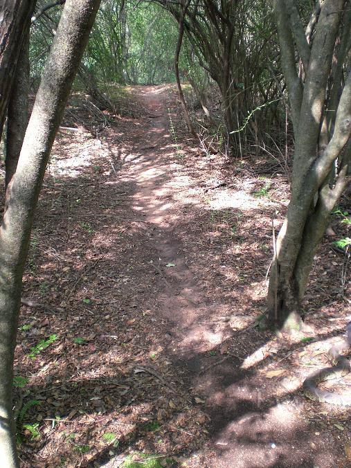

Back to my Alma Mater (MSHRM '94). This was sweet single track that lets you ride fast. Great for beginners, some small to medium roots with a few grades but nothing steep. Two log obstacles, the first is easily bypassed, both under 18". Route was 4.5 miles. Leaf covered and might get sandy in spots with use or in long dry spells but I was through it so fast I question mentioning it at all. Fun short ride and worth trying it. Thanks to the builders - where were you 40 years ago?
| ThankThe ride was great. The forest has started blooming with new leaves and bushes so the landscape has changed since my last ride in the winter. A few big roots here and there but nothing too crazy.
| ThankA bit rooty but this beginner made it through. Trail was in good condition after a pretty hard downpour. Drains well.
| ThankFun trail for the area. Rode it on 6/6/17 after two hard days of rain the trail was in awesome shape. No mud, no ruts, no standing water. It drains very well. Props to the locals who maintain this trail. It's short, but fun. It's worth stopping by if you are in the area.
| ThankIf your in the area and want to explore these trails can offer about an hour of riding. Like all trails in the area there relatively flat. There are more roots and technical features than the nearby forever wild trails but don't expect anything crazy...
| ThankI am a 52 year old re-starter (beginner) with diabetes and found the trail very challenging for me. I only made 3.5 of the 4.4 miles before I hit the service road. It has rained every day for three days prior to the ride including three hour before we road and the trail was not too bad. Some roots. My riding partner just finished and said part of the trail is flooded and has a tree that has falling in the trail. But we had a blast. I look forward to riding again soon.
| ThankThis is my local trail where I am learning to mountain bike. I am a rather timid beginner that only started mountain biking about four months ago. I ride this trail 2-3 times per month and am slowly honing my skills. Then a couple times per month I take my skills on the road to ride other trails in AL, FL, and GA. I personally enjoy riding this trail because it helps me to improve. There are short uphills and downhills, roots, sand (normally not deep), and turns that I can practice on without having to drive a super long distance. This is a nice trail for locals or someone passing through and it is well-maintained. It is a beginner trail so the more advanced riders can just pedal faster to get a great workout! There are no restrooms or changing rooms available, so you might want to plan accordingly. The city of Dothan, AL is nearby with lots of nice restaurants to enjoy after a ride (and Sunday beer sales! Yay!).
| ThankNice beginner level trail. Some roots and sandy spots. No big climbs but enough change in elevation to get the heart rate up if you push the pace. Trail is a bit short but doing several laps solves that. My buddy and I both enjoyed the trail in reverse more than the traditional direction.
| ThankNice beginner level trail. Some roots and sandy spots. No big climbs but enough change in elevation to get the heart rate up if you push the pace. Trail is a bit short but doing several laps solves that. My buddy and I both enjoyed the trail in reverse more than the traditional direction.
| ThankIntroduced my GF to mountain biking on this trail. She was intimidated the first time. Went off and rode more trails and boosted her confidence, now she loves this trail! Good for beginners, but they will need some confidence and some bike handling skills. I'd say it's perfect for any skill level as there is enough to create your own challenges, whether working on speed, endurance, crossing a couple logs, or trying to stick in the trail in soft sand on tight corners. Simply an enjoyable trail when you just want to ride not too far away from town.
| ThankIm a beginer and I loved it. Not a bunch of thecnical stuff. But there are two log jumps.
| ThankA fun trail with a few sections with good flow. Nothing technical but can be fun to ride with some speed. Pretty short at about 4 miles but you can get a pretty good workout by doing 2 or 3 laps.
| ThankExcellent beginner level single-track. If I were rating beginner ST only I'd give it 4 1/2 stars, 5 if there were any beginner technical features or a small skills park. Just a nice easy ride through the woods. Trail is true single-track with lots of small roots. A 29er would be great here, lowered air pressure on my 26in tires, and eliminated most of the trail chatter. More experienced riders might get bored here, but the rule of "just ride faster" definitely applies.
| ThankGood place to stretch the legs if passing through as it is just off the highway.
This was my first time riding this trail. It's not as rough as posted earlier. It's a nice little trail. I'll be riding it more while I'm here in town.
| ThankThe trail is open again. It is a good trail for beginners. Nothing technical. Trail has washed out exposing a lot of roots. The experienced rider may get bored here easily. The best way to make this a challenge is to ride it as hard and fast as you can. Without a good front shock, your hands will probably go numb from hanging on so tight over all the roots. Don't be the first rider out in the morning. You will have a face full of spider webs the whole way!
| ThankClosed until April 2010
| ThankRoad this trail for the first time yesterday and had a blast. I am just starting out and got a great workout and really enjoyed the challenge of the trail...tight turns, challenging downhills, lots of roots which make the trail a challenge. I really recommend trying the Westgate Park trail first if you are just starting out. I road the Westgate Trail twice (7 miles) and then this trail and was spent. Bring water with you because there are no fountains.* Review edited 7/18/2007* Review edited 7/18/2007
| ThankThis is one of the only trails in the Dothan area-judging from the rolling terrain around Dothan, there should be more some available locations to build more trails. TSUD is an easy cross country trail with few technical features that winds between pine stands and oak scrubs. Pros: 1)Trail is close to Dothan and is easy to find, 2)trail drains and dries well, 3)there are a few easy ups and downs - switchbacks(see trail map) are configured uphill followed by a downhill.
| ThankCons: 1)Trail is somewhat rooty and it appears that water run-off is allowed to shed straight down the trail with few erosion controls in place, 2)there are no distinguishable trailmarkers or blazes which mark the trail-but it's easy to find your way, 3) it doesn't appear there is regular trail maintenance, 4) there were no trail maps in the posted "Maps" box. See photos: I stopped to take a pic of some little rollers, little did I know I had just passed a BIG rattler! He was completely still and watched me until I snapped the pic and then when I turned around, tore off into the woods. I had no idea he was there until I heard him moving...I looked at the picture I had taken and saw him in it on the bottom right- eerie! If I had stopped and put my foot down a second earlier than I did, it would've been a bad day for both of us!
Fun ride, several fast sections, a great trail for an evening ride.
| Thank