


This ride is actually two rides in one. The first follows a secondary road through flat open forest country with a short detour to one of the best views on the forest. The second traces a course around secondary and primitive forest roads through some of the wildest area of any ride on the south Kaibab.
Sunflower Flat Road (FR 14) leads you down a quiet country road past a historic cabin surrounded by forests and meadows. J. D. Cabin, off the road and down a short road, is a historic homestead with cabin, barn, and corral settled in the 1870s. James Douglas is buried nearby. His cabin is not open to the public, but it does give a good idea of how pioneers in this area once lived. (See History of this guide.). It also makes a good backdrop for a photograph.
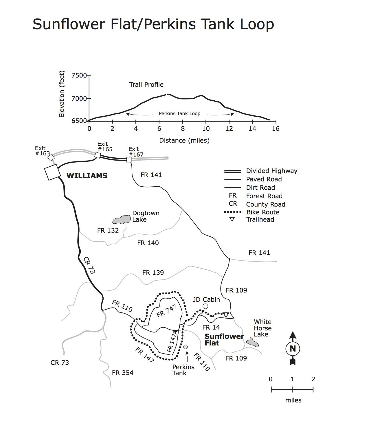
Notice that the forests in this area have been logged extensively in the past. (The oldest, tallest stumps were hand cut with crosscut saws.) At the end of FR 14, turn left on FR 747, left again on FR 110 and ride about a half mile to a great view of a highland meadow with the San Francisco Peaks in the background. A picturesque log corral makes a good foreground for a photograph.
The Perkins Tank portion of the ride starts at the intersection of FR's 14 and 747. You can drive to this intersection and just ride the loop, or you can combine the two rides for a longer, more varied outing. The Perkins Tank Loop follows FR 747 up and over Morgan Hill through open forest. Mule deer frequently can be seen staring back at you from the roadside. After crossing FR 110, FR 147 takes you down a grassy valley and up a steep climb to FR 147A. This road takes you through country that is remote and relatively undisturbed. The road itself is little more than a trail. Watch for wildlife and a good view of the San Francisco Peaks. Where the road surface changes to cinders, you can take a short detour down to Perkins Tank for a little bird watching and trout fishing. Then it's down Perkins Knoll to FR 11110 and back to the trailhead.
The ride follows a number of different forest roads. They vary considerably, but most are infrequently traveled, narrow and winding. There are a few steep climbs separated by a lot of easy riding. The surfaces are mostly smooth with just a few rocky places. FR 147A is a dirt jeep track for most of its length. (It can easily turn into mud in wet weather.) Because of the length of the ride and a couple of lengthy climbs the total loop is rated strenuous. source: fs.usda.gov

Loading reviews...View more