×

|
Rate it:
Tags:
Level:
Length: 5.8 mi (9.3 km)
Surface: Singletrack
Configuration: Out & Back
Elevation: +169/ -489 ft
Total: 1 riders
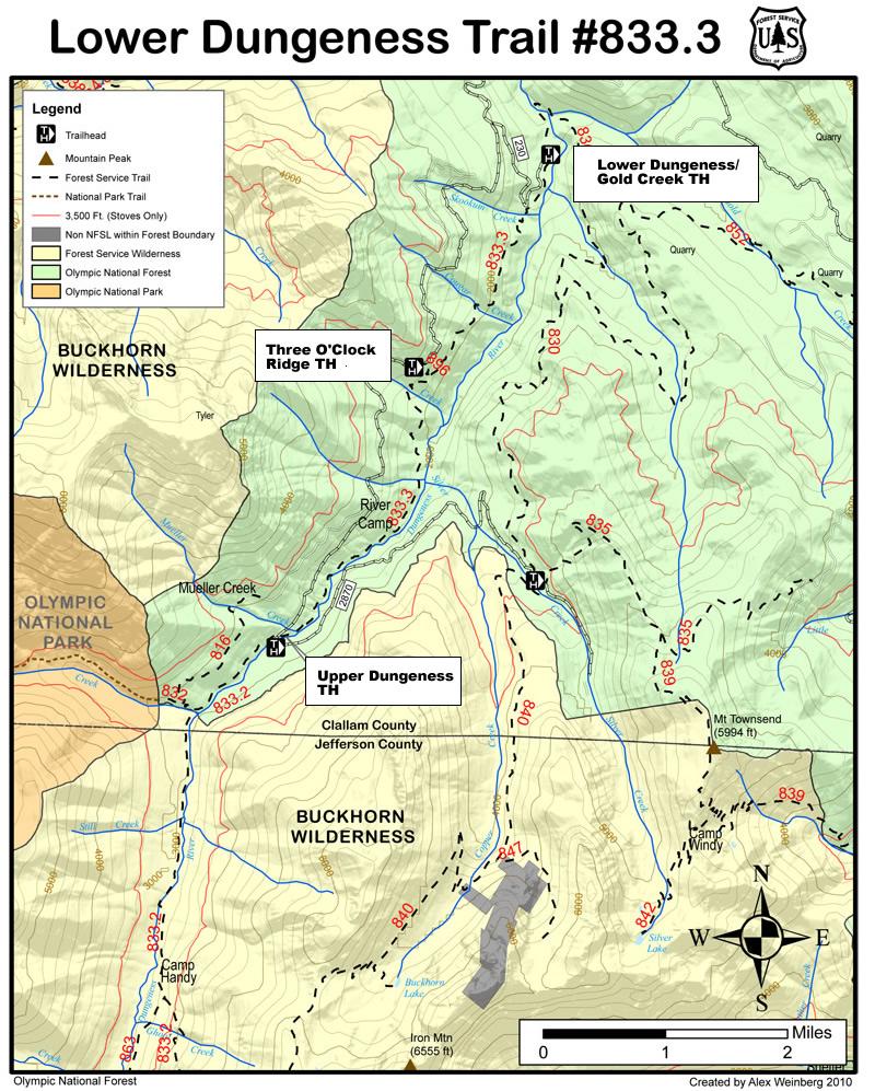
Mountain Biking Lower Dungeness / Trail #833.3
#255 of 1,209 mountain bike trails in Washington
This multi-use trail is within conifer forest above Dungeness River. Mossy rock outcrops and steep side slopes are found in the Three O'clock Ridge area, also some valley and mountain views.
Mountain bikers are asked to avoid using the lower sections during wet weather due to soil types that can sustain a lot of damage. via fs.usda.gov
First added by Jeff Barber on Oct 10, 2014. Last updated Apr 28, 2020. → add an update
Before you go
- Drinking water: unknown
- Drinking water: unknown
- Lift service: unknown
- Lift service: unknown
- Night riding: unknown
- Night riding: unknown
- Pump track: unknown
- Pump track: unknown
- Restrooms: unknown
- Restrooms: unknown
- Fat bike grooming: unknown
- Fat bike grooming: unknown
- E-bikes allowed: unknown
- E-bikes allowed: unknown
- Fee required: unknown
- Fee required: unknown
This trail information is user-generated. Help improve this information by suggesting a correction.
Located at the end of Whiskey Bend Rd. off FS 2909.


Loading reviews...View more