Devisadero Loop (108) trail photo
See all photos (8)
×
User
Today
 
  |   Rate it:

Tags:
Level: Advanced
Length: 5 mi (8 km)
Surface: Singletrack
Configuration: Lariat
Elevation: +2,581/ -2,508 ft
Total: 18 riders
 

Mountain Biking Devisadero Loop (108)

****   Add a review
#27 of 283 mountain bike trails in New Mexico
#1,709 in the world

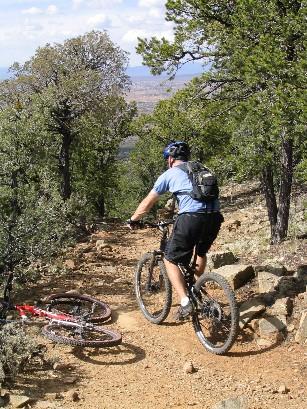
This is a short, 5.7 mile, lollipop loop close to the town of Taos that offers some steep but fun singletrack. While somewhat technical, with a few rock steps and some loose rock, it isnít extreme; the biggest challenge is the steep climb. The climb out of the trailhead (at about 7,160í) is steep enough that I felt it required more heartbeats than I was willing to commit ñ I walked much of it. Once you get to the intersection of the loop it gets easier and pedaling isnít too hard, but it is still difficult in places. I canít say whether it is better to go clockwise our counter-clockwise around the loop; I lean toward going clockwise. Riding clockwise, the trail works its way thru the cedar and pine to a nice overlook, then to the north side of the hill there is a short section of fun singletrack thru thicker forest, and then you continue climbing to the top of Devisadero Peak (8,304í) where you can recline and relax in easy chairs cleverly constructed from slabs of rock. From there it is a fast ride down sharp switchbacks to the fork, and then back down to the trailhead.

The Capulin Trail connects at the eastern corner of the loop ñ if you want to add a lot more miles then continue on up the Capulin till you run out of gas or end up coming back down Capulin Canyon.

First added by bonkedagain on Oct 10, 2006. Last updated Apr 29, 2020. → add an update
Before you go
  • Drinking water: unknown
  • Lift service: unknown
  • Night riding: unknown
  • Pump track: unknown
  • Restrooms: unknown
  • Fat bike grooming: unknown
  • E-bikes allowed: unknown
  • Fee required: unknown
This trail information is user-generated. Help improve this information by suggesting a correction.
Getting there
The trailhead is on highway 64, just after the road enters the canyon, by the "Welcome to Taos" sign. Look for the obvious large parking area.
Featured in


Devisadero Loop (108) Trail map

Add to or improve this map // Share this map on your website

Local Info

Club Sponsor

-

Trail checkins

sayerdan4th (on Aug 25, 2023)
What's this?

Upcoming Events

None.
Add one

Trail conditions

Wet (on Sep 29, 2017)
login to update

Camping & Lodging

Coming soon!

Devisadero Loop (108) videos

Add a video
We don't have any videos of this trail yet. Add one here.

Mountain Bike Trails Near Taos, New Mexico

*****
Beginner | 9 mi
*****
Advanced | 6 mi
****
Intermediate | 11 mi
| 4 mi

Add a review

Rating
 
Difficulty
 
Review

Reviews

    Loading reviews...

Rider questions