singletracks is mountain biking
Sign In | Create Your Account | Site Map | Help  


Colorado Trail / South Platte To Buffalo Creek Mountain Bike Trail

Deckers, Colorado

MTB TRAIL STATS

Avg Rating: 4 trail reviews
Status: Open
updated 5/21/07 by JJonas
Difficulty: Advanced bike trail Advanced
Length: 20 miles Global Rank: #Not yet ranked.
Tread: Singletrack Configuration: Out & Back
Ridden: 48 Wishlist: 48
Avg. Speed: 6.12 mphAvg. Time: 4hr 40min
Elevation Gain/Loss:
+3,708/-3,844 ft
 
 
This trail is part of the Colorado Trail trail system.
Directions: To view directions to Colorado Trail / South Platte To Buffalo Creek mountain bike trail, please login. If you don't have an account, sign up now: it's free, only takes a minute, and gives you access to tons of other rad features.

Description: 
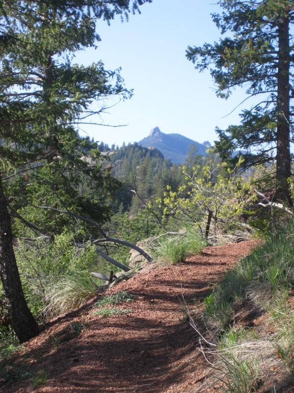
The initial climb out of the parking lot is by far the hardest part of this section of the Colorado Trail. Within the past several years, a re-routed portion of trail was created and if you carry a map with you, it might show the trail going northwest, instead of the correct southwest. However, the trail is very well marked and easy to follow. Once the initial mile or so of climbing on pea gravel is out of the way, the degree of steepness does ease up somewhat, although this trail continues gradually upward for many more miles. While we were prepared to do some climbing, this section of the CT really kept it coming.

Luckily, the grade is never too steep so that you should be able to grind up most of this trail. The first 1/3 of this trail is burned out from a recent forest fire, and is quite interesting to ride through. The second 1/3 of the trail is normal forest, while the last 1/3 is back in the burn zone (you will cross a fire road at one point, and although the trail has no markers on the other side, you DO want to cross the road and continue on the singletrack). The last 1/3 is definitely more level, although you will encounter a variety of ups and downs and at times, some very fast singletrack! The final mile from Hwy 126 to the Little Scraggy Trailhead (where many park for rides into Buffalo Creek area) is nice and flat doubletrack.

The trip back from Little Scraggy is where this section of trail really shines. On the return, your first 1/3 is fun ups and downs, the middle 1/3 has one short uphill section which will be the last of the climbing for the day...and the last 1/3 is pure downhill for what seems like forever! This is payback for all the climbing you had to do on the way in... None of this trail is particularly technical, and most of it is well traveled and well worn. Naturally you can get some pretty good speed going since your visibility in the burn zone is fairly distant.

You will need to bring as much water as you can, especially in the summer months, as there are no water sources on this section of trail. If all goes wrong, you can bail out on Hwy 126 and head down the hill back to the "town" of Buffalo Creek (and take the gravel road back to your car). If you have a water filter, you can water up at that point. However, all effort should be made to ride this trail in both directions, as the return back down the hill is really worthwhile. Set aside 3-4 hours to do the entire route. More if you like to stop, enjoy the scenery, etc.
added on January 6, 2005 by Siberian
Map   Videos   Photos  

SIMILAR TRAILS

Riders who liked this mountain bike trail also liked:
 
Copper Triangle in Copper Mountain


Palmer Trail / Section 16 in Colorado Springs
 

TRAIL REVIEWS   review this trail


reviewed by pdinsurance on September 12, 2010

Epic ride, Started at buffalo creek and rode about 6 miles past south platte, although comming back felt like alot of climbing. It was hot and exposed. A little sandy and loose in spots. Trail was very well marked

Similar Trail: Buffalo creek


reviewed by petersbike on June 9, 2005

Just rode the trail the other day, and the singletrack is smooth and fast. Also it was the most beautiful trail I,ve ridden in years. Travelling through the burn zones, there is an abundance of wildflowers that will blow your mind. Have fun.

Similar Trail: Other Buffalo Creek rides. Tsali. Cactus Cup loop.


reviewed by Scopebite on May 28, 2005

As that last guy said- Bring as much water as you can carry. I reccomend to hit this one in the Mornig as it will be alot cooler. The first part is really open and you are going to bake like a cake in the sun. After the initial climb it is alot of fun and the payoff ride back to the car is well worh it.


reviewed by warrubi on May 19, 2005

The initial climp from the start of the trail is about 3 miles until it levels off somewhat. Like mentioned before bring as much water as you can carry in the summer months. After the first 3 miles the trail is a fun single track ride.

MTB Trail Dashboard

Tags (comma separated)

cancel

Widget Code
copy and paste this code onto your website.
Horizontal Vertical Trail Name


Site Map | Advertise | Partners | Contact Us | Terms | Privacy
Campground Reviews | Hiking Trails | Trail Running | Skiing / Snow Sports | Mountain Biking
Copyright 2012 Blue Spruce Ventures LLC | Atlanta, GA
singletracks.com is yet another slick Review App
 
time: 0.16370701789856 seconds