×

|
Rate it:
Tags:
Level: Advanced
Length: 9 mi (14.5 km)
Surface: Singletrack
Configuration: Loop
Elevation: +364/ -372 ft
Total: 33 riders
Mountain Biking Camp Thunder
#123 of 412 mountain bike trails in Georgia
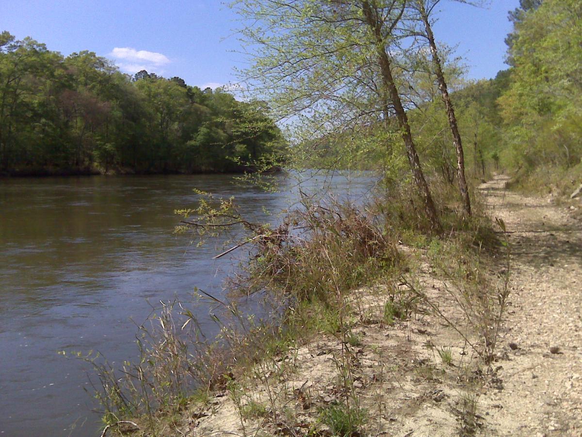
Your journey begins along the river on a rocky fire road, then you start the most feared climb in Georgia. I have heard people at Tsali speak with reverence about this 2 mile gravelly climb up the switchbacks. Not for the faint of heart. You are, however, richly rewarded for your efforts by some very fast downhill sections, moguls and whoop-tee-doos. Don't misunderstand, I love this place! Watch out in the rock gardens, and keep in mind that you will be suffering. People fear this trail just a little too much.
First added by on Jan 1, 2003. Last updated May 6, 2020. → add an update
Before you go
- Drinking water: unknown
- Lift service: unknown
- Night riding: unknown
- Pump track: unknown
- Restrooms: unknown
- Fat bike grooming: unknown
- E-bikes allowed: unknown
- Fee required: unknown
This trail information is user-generated. Help improve this information by suggesting a correction.
Take 74 out of Thamston to the sign to the Camp


the climb just wasnt worth the rewards to me. the ride in along the river is nice but once you turn to go uphill, the fun stops. One climb from hell, not technical, just long and steep. signs are still a mess. no real airtime anywhere I could find. Lots of overgrown trails that are sure to leave you with chiggers somewhere on you. Maybe with someone that knows the trails or the encrypted paint markings on the trees for routes it would be better. But hey if you want the longest boring climb in Georgia this is your place
| ThankWas an intense riding experience that I haven't seen in awhile ! Long descents that I got over 40 mph !!! Then there was the climbs. I thought I was back in Virginia climbing the Shenandoah trail. Lose rock, roots, and baby head rocks are notorious on this trail, so be careful. I didn't get any flats thank God !!! A Very enjoyable trail. I'll definitely make a trip back down there in the near future.
| ThankI have ridden there 3 times now. Mix of really wide trail (not exactly double track) and single track. Some of the single track is getting a bit grown in. Take Muddy Slash trail from the Adventure Center to the top and pick your poison. Great trails, what mountain biking trails should be like. If you like groomed trails don't go here. Trail map is good to bring. http://ini-to324.org/trails/PMBC_Map_02182012.pdf
| ThankThe trail is open, but you must be a member of the Pine Mountain Back Country "TRAIL Boss" program (Boy Scouts), or be a guest of a member. There is about 17 miles now with the singletrack that has been added. New signage makes it easier to navigate and you can even find bathrooms throughout the ride.
Visit the PMBC facebook page and contact Keith Larson for more information.
https://www.facebook.com/groups/212525105436703/
| ThankEven though it has been about two months since i have been there, i updated it as open since my visit was more recent than trek7k's last update.
Neat place. The terrain is far different than anything in the surrounding area. It is a mix of double track/fire roads with connecting single track.
It would be wise to take someone that knows the trail with you as it is very confusing. Got lost for a while after the gps program i was using on my phone locked up. I just kept wandering until i finally found the long switch back that leads down to the river (best part of the whole ride). There are some long, steep climbs that had me doing a lot of walking. It also had fun down hills to go with it though. Definitely left me worn out. It's worth a visit if you don't live too far.
| ThankA couple of us rode this today and didn't see any signs that this trail was "officially" closed. Having said that this trail is a monster and if you want 11 miles of pure hell challenge, you've come to the right place! The first mile is flat, however, the rocks are big, couple wet spots, and deep sand. After that, it's uphill. There's some nasty downhills on this trail as well. I'm a total beginner and I won't lie, I finished this trail hurtin' & walked most of it. 3 suggestions.. (1) Plenty of water; (2) ride with someone & (3) verizon in case you get into trouble.
| ThankGot permission from a Scout leader to use the trail. Headed out early this morning and had a little trouble finding it as there are absolutely ZERO markings to the trail head. Once I asked around and got to the trail I toughed it out through the climb everyone is talking about, after some swift downhill and another climb, the trail spits back out onto some forest road with no markings. I wandered around for literally an hour trying to find where the trail continued, got lost and ended up back out on the main road in front of the scout camp. What I did ride was awesome but I gave it a 3 for the poor, POOR markings. The only reason I was sure I was on the trail was some chain ring marks in a log and I found a Clif Bar wrapper at one point. VERY FRUSTRATING! This trail has a ton of potential! There is nothing in the area to compare to this climb. I wish I could have found the whoop dees everyone talks about.
| ThankDrove out on 6/10/09 and talked to a staff member who said the trails have been closed to the public for about a year and a half. Too bad - looks like there is some interesting topography in the area...
| ThankThis ride sucked! Why we searched & searched for this trail. Talked to locals, but never found! Grrr!!!
| Thank