×

|
Rate it:
Tags:
Level: Advanced
Length: 15 mi (24.1 km)
Surface: Singletrack
Configuration: Lariat
Elevation: -
Total: 20 riders
Mountain Biking Beardance
#22 of 265 mountain bike trails in Montana
Start climbing right off the bat up beardance trail 314, and hang a right on
trail 76 at the fork. climb until you hit forest road 498, and hang a left. ride
along that road until you can hook up with 314 and drop back down 314 all
the way to where you started. **This trail is not in the Glacier Cyclery ride
guide** Be sure to pick up the Swan Lake Ranger District map for
reference. This trail contains a stinking killer climb on the way up, but a
sweet stinking descent on the way down, with some uber steep tight
switchbacks, a whole ton of rocks and roots, some drops, and some super
flowy, beautiful singletrack!! Not to mention some of the best views of
Flathead lake anywhere!!! This one is a must-ride.
First added by Greg Heil on May 5, 2009. Last updated Apr 28, 2020. → add an update
Before you go
- Drinking water: unknown
- Lift service: unknown
- Night riding: unknown
- Pump track: unknown
- Restrooms: unknown
- Fat bike grooming: unknown
- E-bikes allowed: unknown
- Fee required: unknown
This trail information is user-generated. Help improve this information by suggesting a correction.
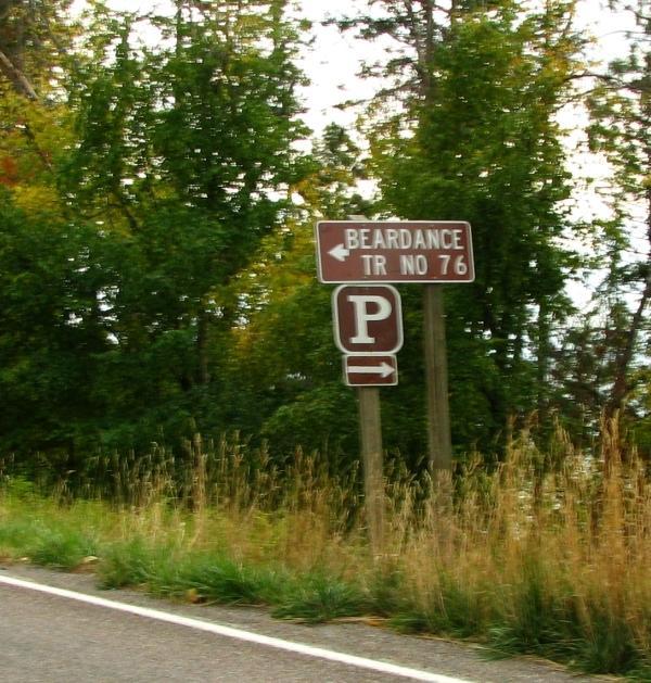
From Bigfork, head south on Hwy 35 along flathead lake. About halfway
down the lake, you will see signs for the Beardance trailhead, and the
pulloff will be on your right between the highway and the lake, with the trail
starting back across on the other side of the highway.


Loading reviews...View more